
Central index
Search across articles, concepts, methods, places, and Field Collection records without forcing knowledge into one format.
Knowledge Library.
Knowledge index
40 records
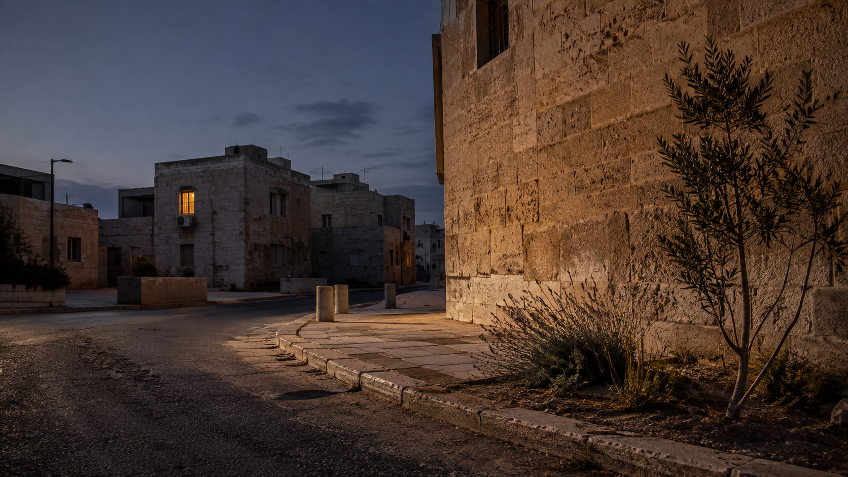
The Thermal Memory of a City: Why Heat Does Not End at Sunset
A short climate essay about nighttime urban heat and the thermal memory of the built environment. The piece follows the heat stored in streets and buildings through the evening, asks why warm nights matter biologically, and considers why adapting to hotter cities requires protecting the hours when bodies, buildings, and landscapes are supposed to recover.
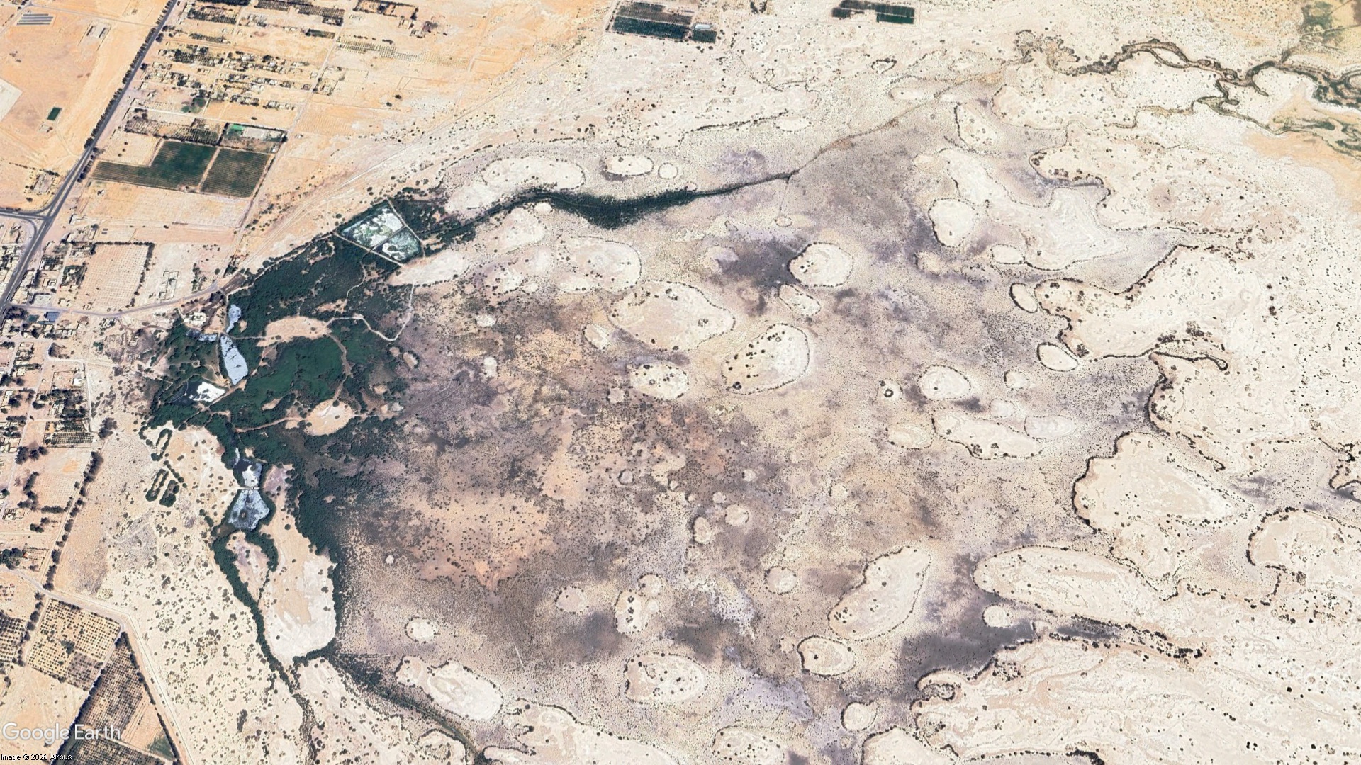
The Wetland Seen From Space: What Greenness Means at Qa al-Azraq
A research-led reading of vegetation recovery at Qa al-Azraq in Jordan. Satellite analysis documented a major expansion of vegetation between 2015 and 2025, while bird monitoring, groundwater evidence, and the artificial pumping that sustains part of the wetland reveal a more complicated ecological story. The article asks not only what remote sensing can show about recovery, but what kind of water future can sustain Azraq without reproducing pressure on its depleted aquifer.
Azraq Wetland Reserve, Zarqa
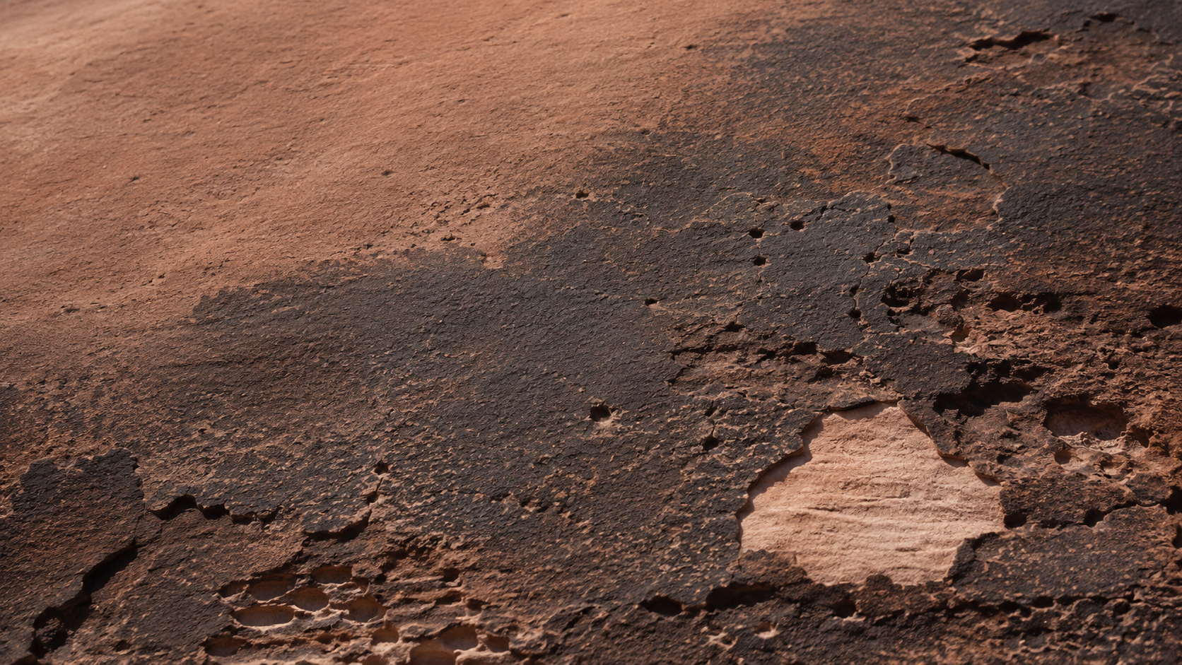
The Dark Skin of Stone: Desert Varnish in Wadi Rum
A close reading of desert varnish in Wadi Rum, Jordan, from its clay, iron, and manganese-rich composition to the unresolved question of how it forms. The article also considers the relationship between dark rock coatings, weathering, and the extraordinary record of petroglyphs and inscriptions preserved across the protected landscape.
Wadi Rum Protected Area, Aqaba
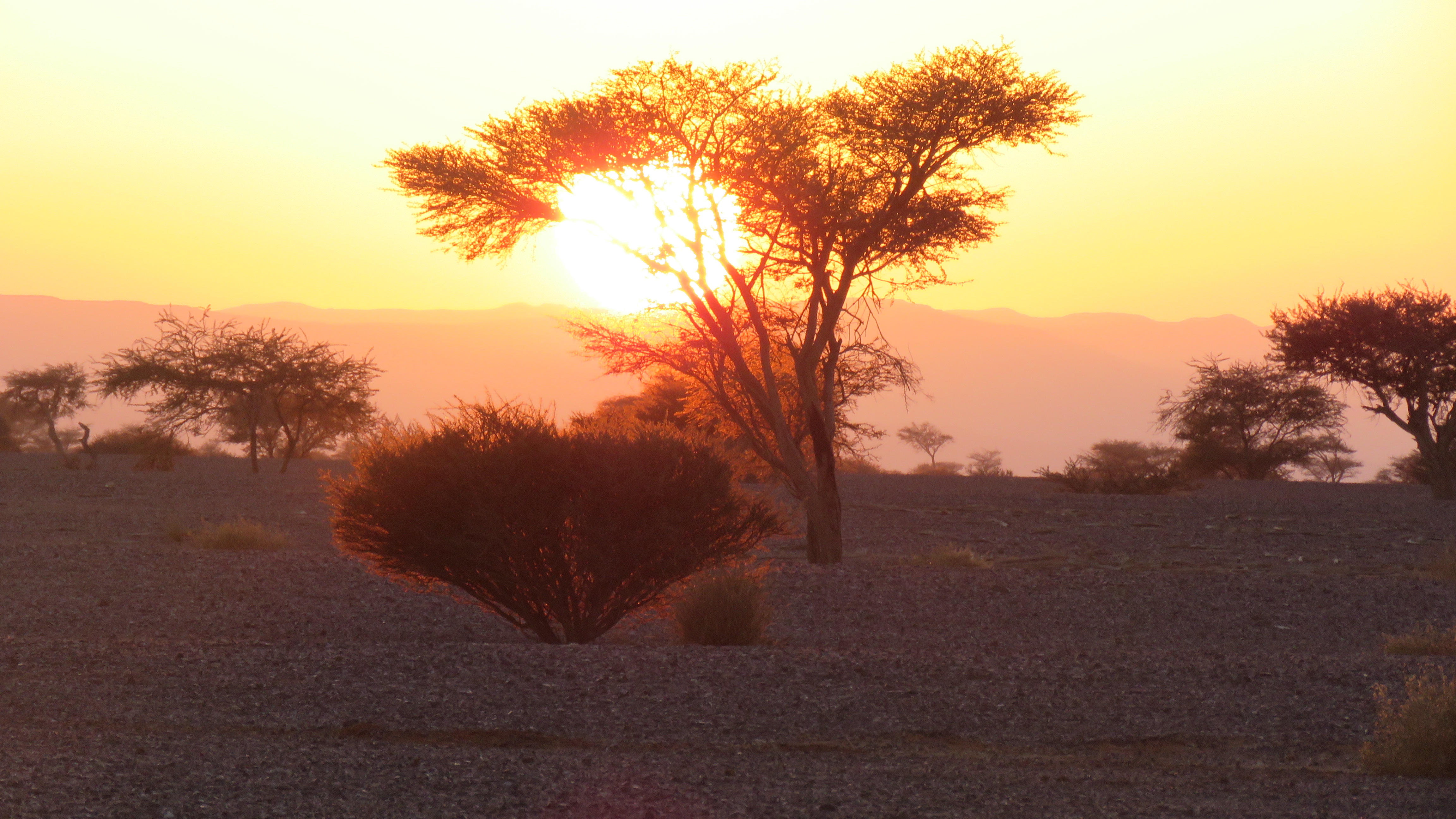
Under the Acacia Crown: Trees of Wadi Araba
An ecological reading of the native acacias of Wadi Araba, Jordan, exploring their relationship with water, landform, soil, shade, and other species. Rather than treating the trees as isolated botanical objects, the article looks at the small ecological worlds that form beneath and around their crowns.
Wadi Araba Sub-District, Aqaba
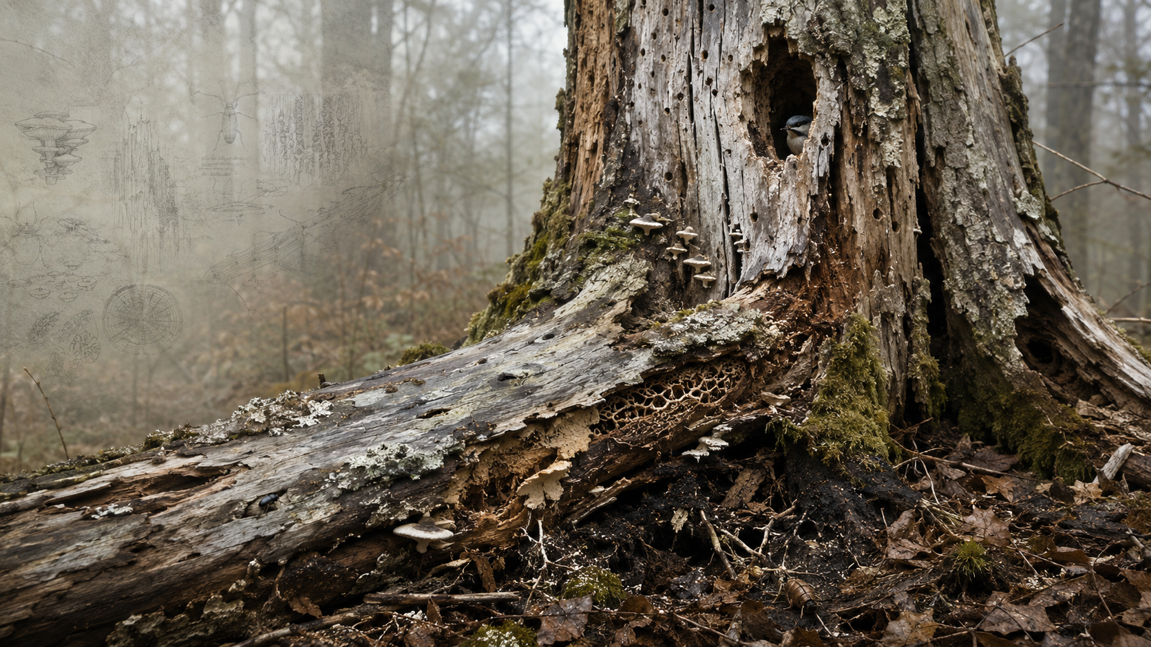
A Dead Tree Is Still Habitat
A short ecological reading of deadwood as habitat rather than waste. Standing snags, fallen trunks, cavities, bark, fungi, decaying heartwood, and contact with soil create a changing sequence of habitats used by organisms at different stages of decomposition. The article invites a slower way of looking at dead trees, not as empty remains, but as structures still participating in biodiversity, nutrient cycling, carbon dynamics, and forest renewal.
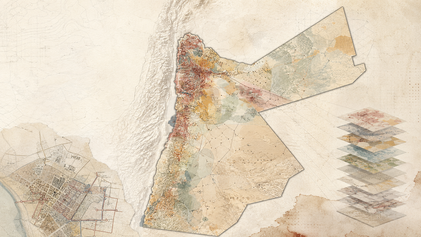
Mapping Sanitation Vulnerability in Jordan
This research developed a GIS-based Sanitation Hotspot Index for Jordan to identify districts and neighborhoods with the greatest need for sanitation intervention. Using the Analytic Hierarchy Process, expert and stakeholder input, and multiple spatial datasets, the study combined ten criteria into a national vulnerability model. The resulting maps were designed to support sanitation planning, funding allocation, donor prioritization, and infrastructure investment.
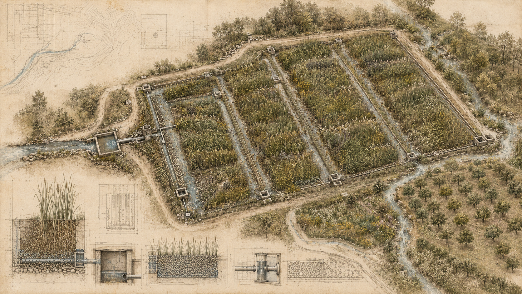
Constructed Wetlands: When Wastewater Treatment Becomes Landscape
A Field Guide to constructed wetlands as nature-based wastewater infrastructure. It explains how engineered wetland systems treat wastewater through physical, biological, and chemical processes while offering opportunities for low-energy operation, decentralized treatment, water reuse, biodiversity enhancement, landscape integration, and circular resource management. It also examines their limitations, including land requirements, pretreatment, clogging, maintenance, and the need to match treatment performance with intended reuse.
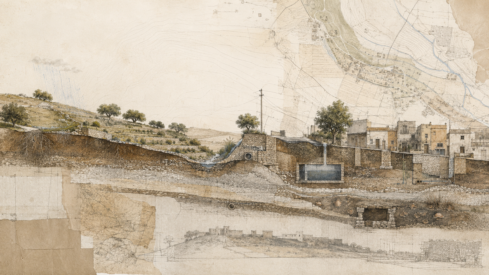
Why Sections Reveal What Plans Hide
A Field Guide to the section drawing as a planning instrument rather than a presentation graphic. It explains how sections reveal vertical relationships that maps can flatten, how to choose meaningful transects, how to combine field observation with GIS and topographic data, and how sectional thinking can expose hydrological, ecological, infrastructural, and urban relationships before planning decisions are fixed.
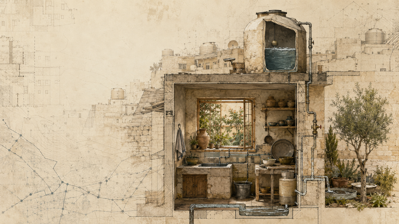
Planning Happens in Kitchens
A reflection on everyday planning through the experience of intermittent water supply in Jordan. The article argues that households do more than cope with scarcity: they forecast, prioritize, coordinate, adapt, reuse, and learn. Drawing on insurgent planning, counter-conduct, democratic planning, and the changing role of the planner, it asks whether planning should focus less on inviting citizens into formal processes and more on recognizing the planning practices citizens have already created.
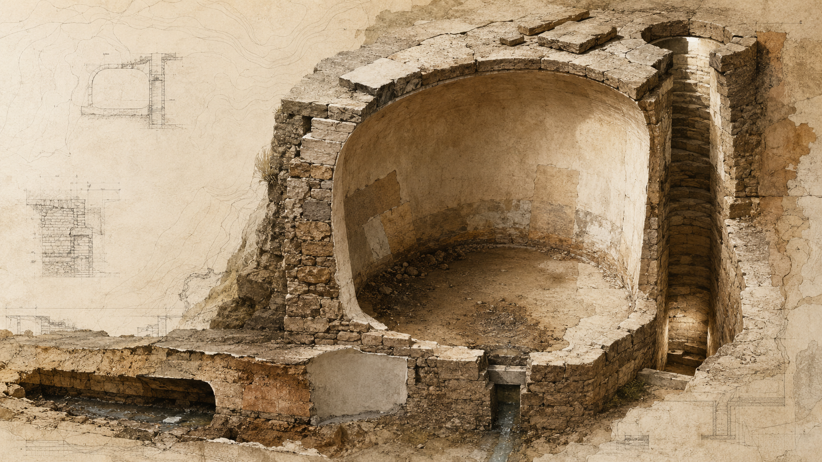
Ancient Water Systems Were Built to Be Maintained
A historic lesson about maintenance as an integral part of water infrastructure. The guide reads access shafts, inspection openings, sediment traps, repair masonry, channel linings, overflow routes, and maintenance paths as evidence that water systems were designed for continued intervention rather than permanent completion. It connects archaeological observation with contemporary planning questions about accessibility, stewardship, repair, and the long-term operation of decentralized infrastructure.
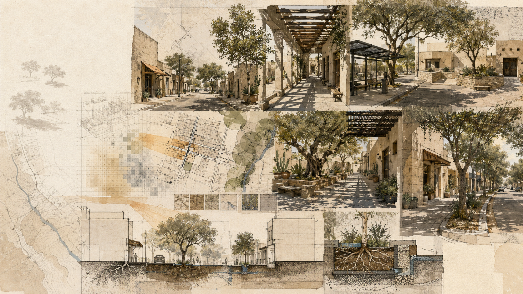
Shade as Urban Infrastructure
A Field Guide to reading shade as a spatial system rather than a decorative feature. It explains how solar exposure, street geometry, trees, arcades, canopies, surface materials, season, and time of day combine to shape outdoor comfort, and shows how planners can map and design shade networks across streets, transit stops, public spaces, and everyday walking routes.
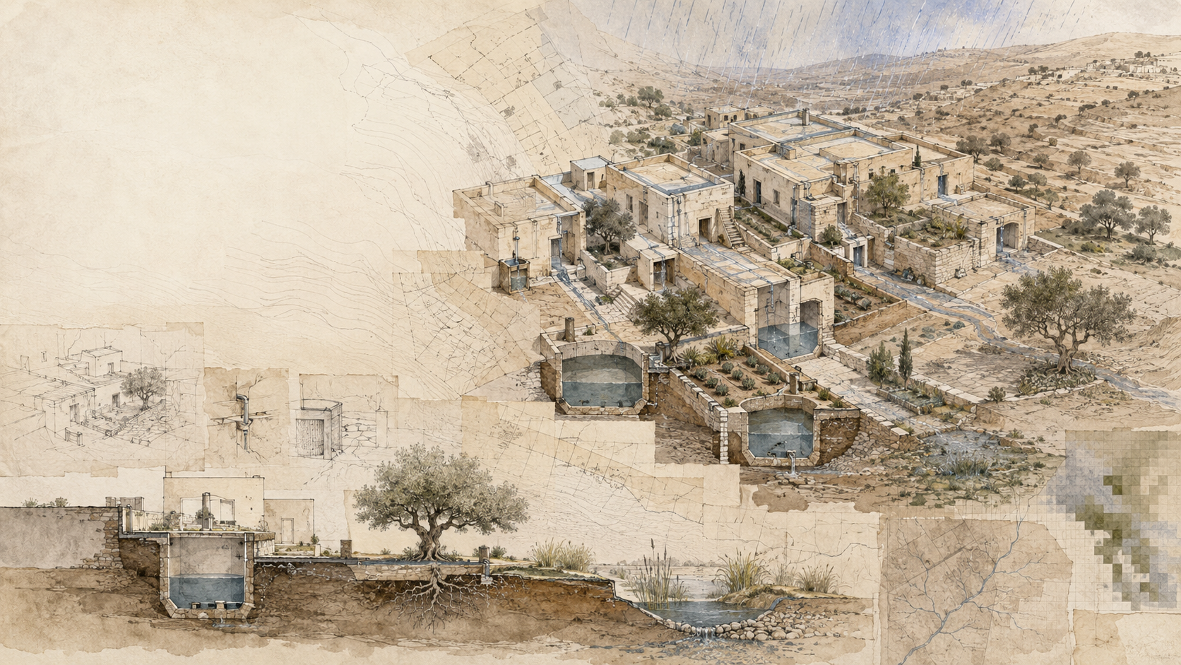
The Cistern as a Planning Unit
A field guide to reading rainwater cisterns as distributed water infrastructure rather than isolated tanks. It follows water from catchment to conveyance, storage, use, overflow, and maintenance, and shows how planners can map these relationships across buildings, sites, and neighborhoods.
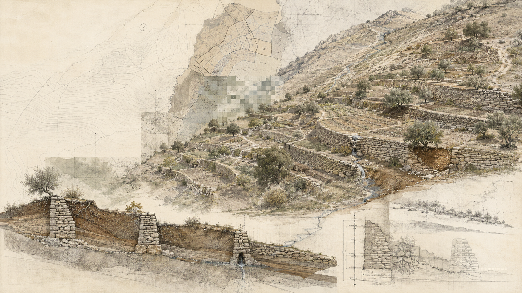
Reading Terraces as Slow Infrastructure
A field guide to reading terraces as landscape infrastructure rather than isolated walls. It explains how terraces alter slope geometry, runoff pathways, soil retention, cultivation, and maintenance, and offers a practical method for interpreting terrace systems through topography, field evidence, historical imagery, and GIS.
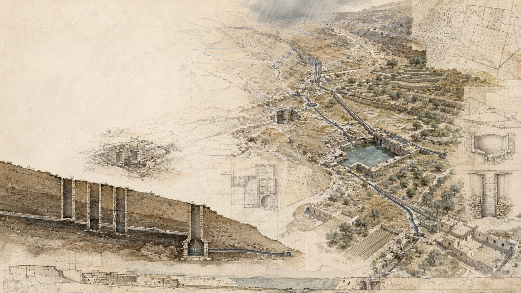
Reading Ancient Water Systems as Landscape Infrastructure
A field guide to reading ancient water systems as complete landscape infrastructures rather than isolated monuments. It offers a method for tracing water from source to use, distinguishing capture from conveyance and storage, recognizing the role of topography and maintenance, using GIS carefully, and interpreting surviving remains without overstating their original function.
Places
Place
Azraq Wetland Reserve, Zarqa
Azraq Wetland Reserve, Al Azraq, Azraq Sub-District, Jordan
Azraq Wetland Reserve, Zarqa, Jordan
Places
Place
Bronte Creek, Ontario
Bronte Creek, Burlington, ON, Canada
Bronte Creek, Ontario, Canada
Places
Place
Grindstone Marshes Trail, Ontario
A coastal wetland at the western end of Lake Ontario where open water, marsh vegetation, shoreline habitat, and surrounding urban landscapes create important space for birds and other wildlife.
Grindstone Marshes Trail, Ontario, Canada
Places
Place
Kafrein Dam, Balqa
Kafrein Dam, Shoonah Janoobiyah Sub-District, Shoonah Janoobiyah District, Balqa, Jordan
Kafrein Dam, Balqa, Jordan
Places
Place
Petra, Maan
Petra, Maan, Jordan
Petra, Maan, Jordan
Places
Place
RIM Park, Ontario
RIM Park, 2001 University Avenue East, Waterloo, ON N2K 4K4, Canada
RIM Park, Ontario, Canada
Places
Place
Roman Theater, Amman
Roman Theater, Hashemite Plaza, 11110 Amman, Jordan
Roman Theater, Amman, Jordan
Places
Place
Wadi Araba Sub-District, Aqaba
Wadi Araba Sub-District, Jordan
Wadi Araba Sub-District, Aqaba, Jordan
Places
Place
Wadi Rum Protected Area, Aqaba
Aqaba Sub-District, Jordan
Wadi Rum Protected Area, Aqaba, Jordan
Places
Place
كفر كيفيا, Irbid
كفر كيفيا, Mazar Shamali Sub-District, Jordan
كفر كيفيا, Irbid, Jordan
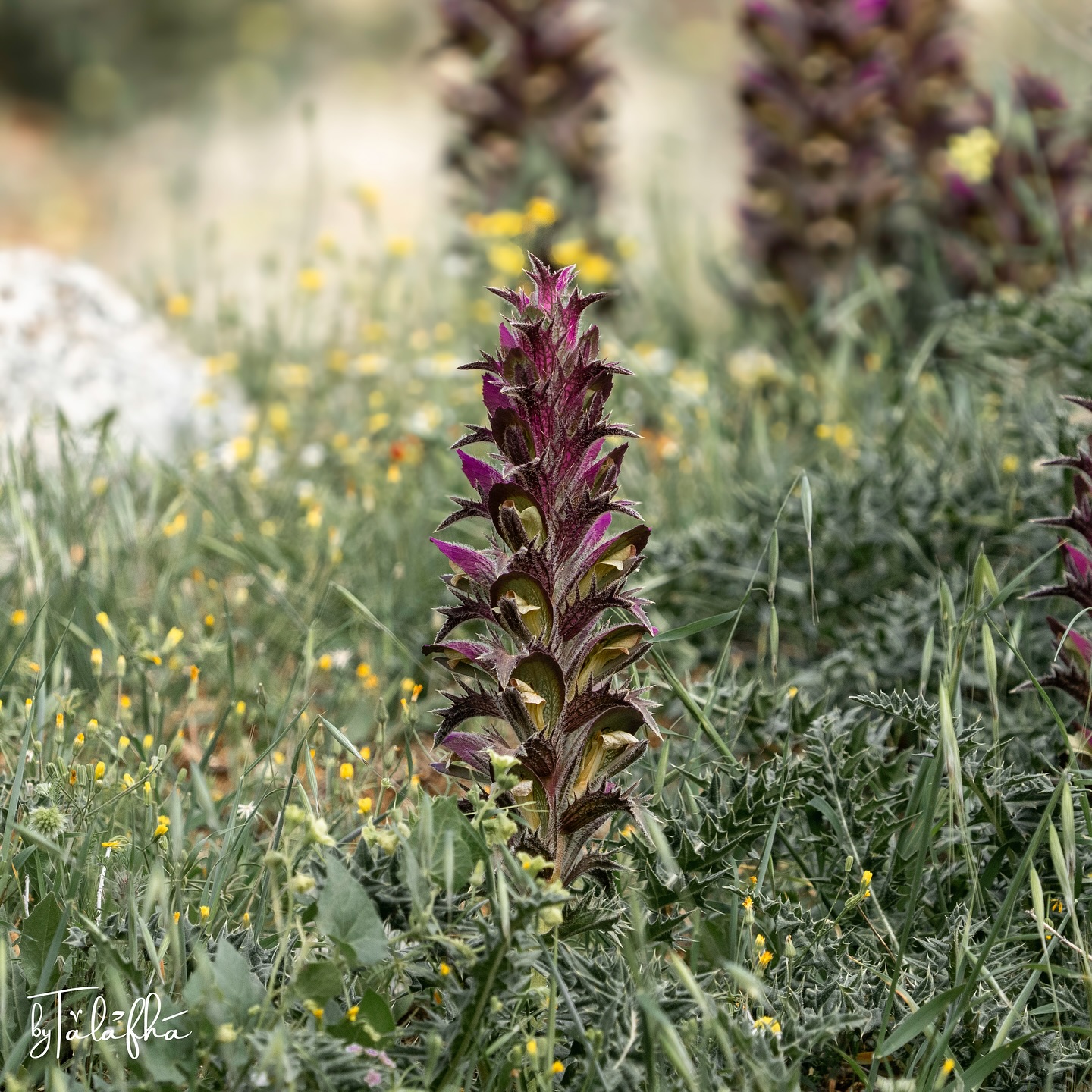
Acanthus
Acanthus growing among rocky ground and spring vegetation in the hills of northern Jordan. The plants form dense basal rosettes of deeply lobed, sharply toothed leaves, from which upright flower spikes rise in dark purple and green. The photographs show several flowering individuals growing together within a mixed herbaceous landscape. The plant is especially significant because the form of acanthus foliage became one of the most recognizable motifs in classical architecture. Stylized acanthus leaves were carved into Corinthian capitals across the Greek and Roman worlds, including monuments in Jordan. The resemblance is not a literal copy of a single species, but rather an architectural abstraction of the plant’s deeply divided and curling foliage. Placed beside a photograph of a Corinthian capital, the record becomes an observation of continuity between living vegetation and built heritage. A plant still growing in northern Jordan carries a visual language that was translated into stone centuries ago.
كفر كيفيا, Irbid, Jordan
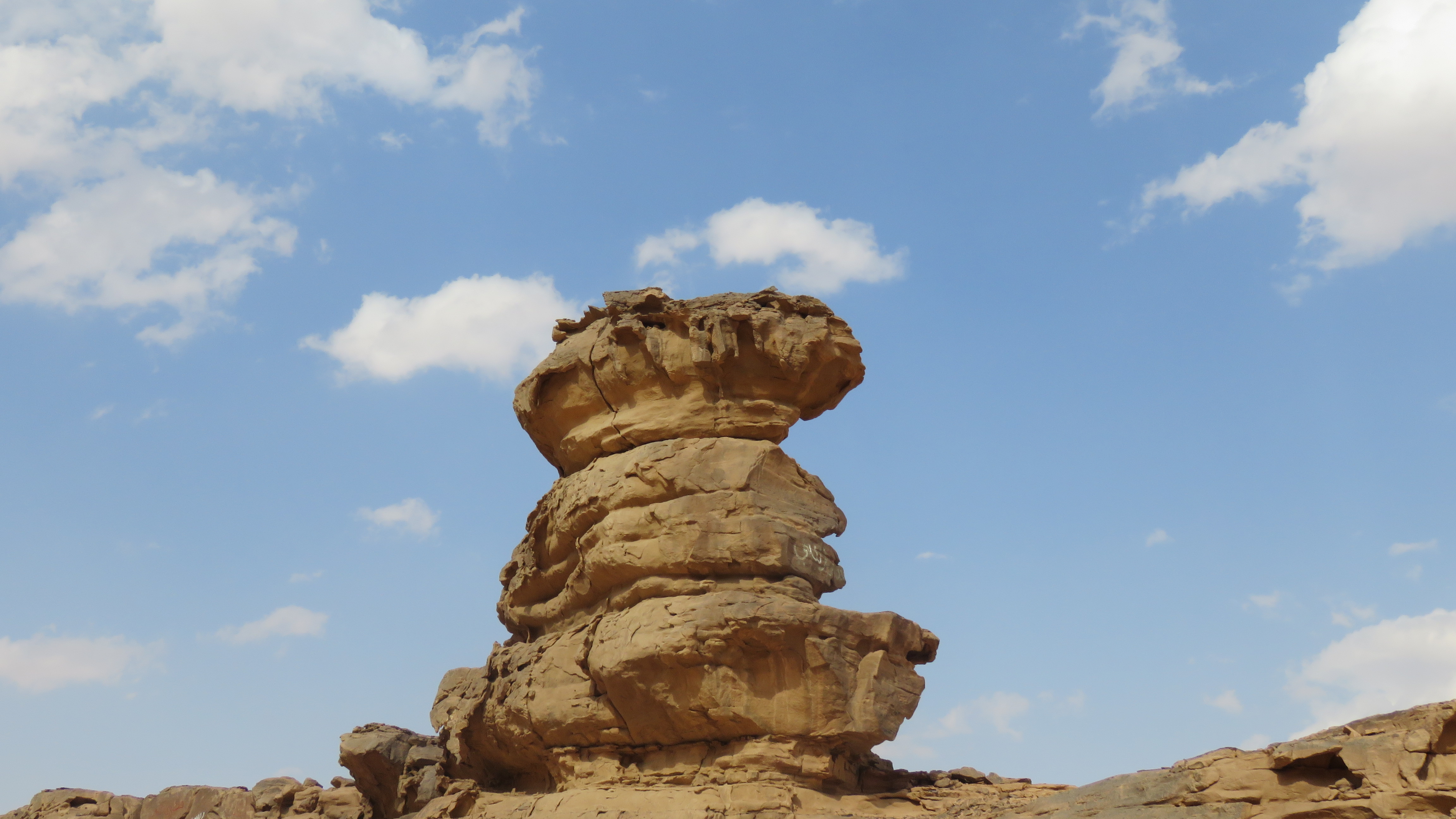
Hoodoo-like sandstone formation
A freestanding sandstone formation rises above a low rocky escarpment near Disi, east of Wadi Rum. The feature consists of stacked, irregularly weathered rock masses, with a broader resistant cap above narrower eroded sections. From different angles, the formation reads as a compact column shaped by differential weathering rather than a single uniform block. The surrounding landscape is dry and sparsely vegetated, with exposed sandstone, sandy deposits, and low rocky benches. The photographs show the formation at both landscape and close scales, making its layered structure and undercut surfaces clearly visible. The term “hoodoo” is reasonable as a descriptive geomorphological label here because the rock has a column-like form with differential erosion between harder and softer layers. However, without geological mapping or site-specific geomorphological documentation, I would avoid presenting a precise formation mechanism beyond that general interpretation.
Wadi Rum Protected Area, Aqaba, Jordan
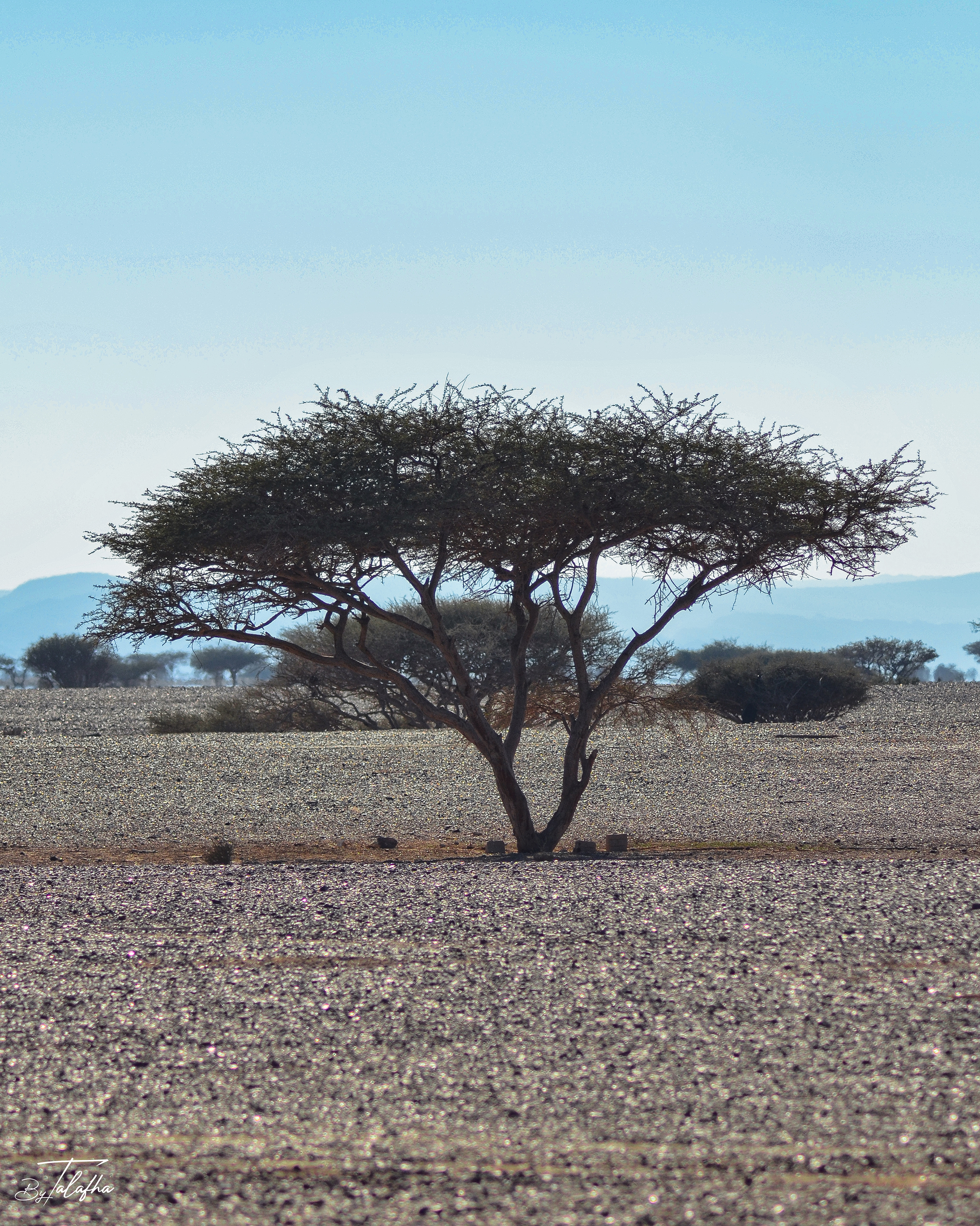
Umbrella thorn acacia
Scattered acacia trees and thorny shrubs occupy an open gravel plain in Wadi Araba, Jordan. The sequence records several growth forms, from broad flat-topped trees with open branching structures to denser, lower shrubs, all standing within a sparsely vegetated arid landscape of gravel, sand, and distant mountain ridges. The larger trees show the characteristic architecture often associated with drought-adapted acacias of southern Jordan, including spreading crowns, multiple stems, small leaves, and widely spaced growth across dry terrain. However, the photographs do not show enough diagnostic detail of leaves, pods, flowers, or thorns to support a confident species-level identification. As a Field Record, the value of the sequence lies as much in the landscape pattern as in the plants themselves. These trees punctuate an otherwise open desert surface, creating shade, vertical structure, and localized habitat in one of Jordan’s driest environments.
Wadi Araba Sub-District, Aqaba, Jordan
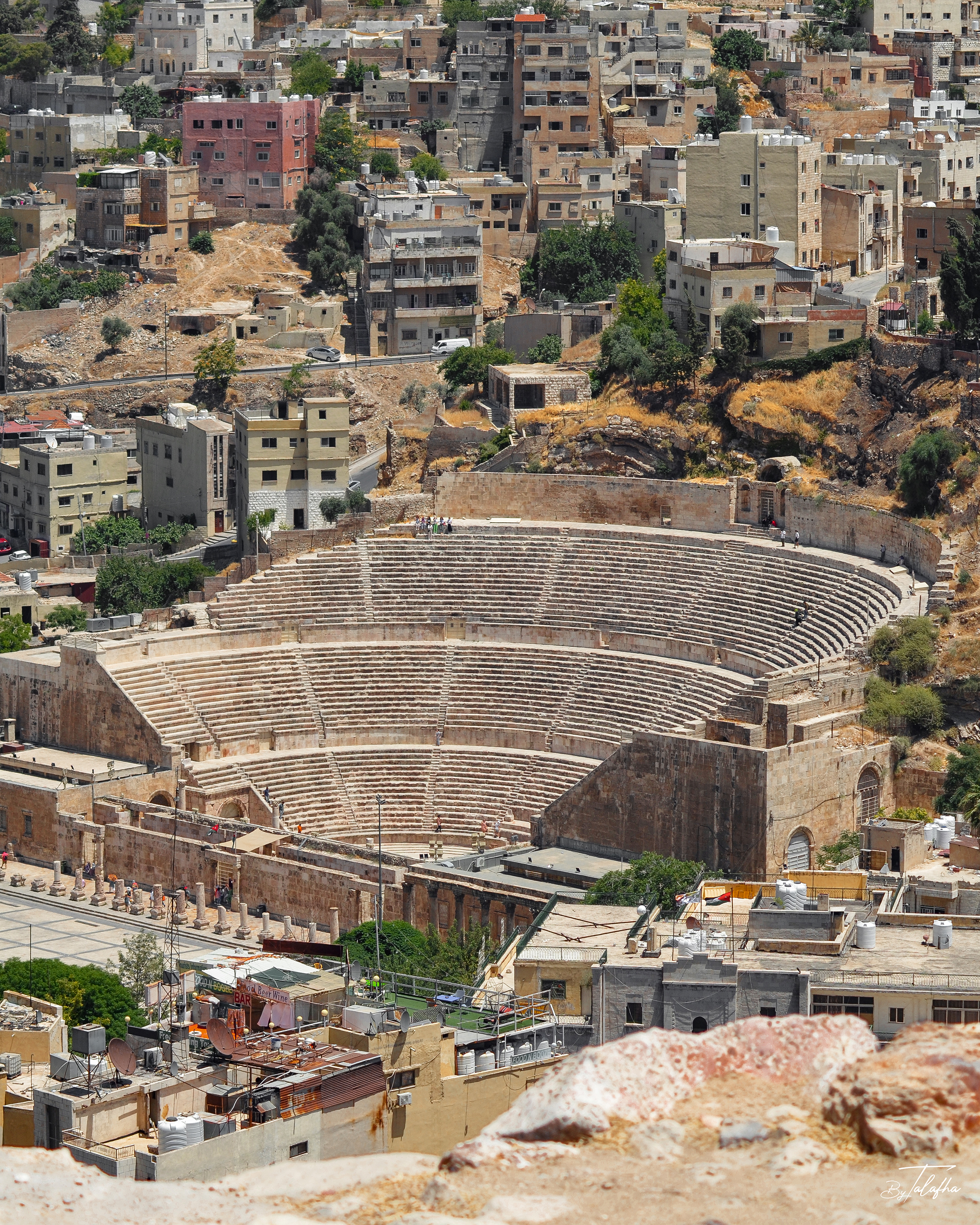
Roman Theater of Amman
A high-angle view of the Roman Theater in central Amman, framed not as an isolated archaeological monument but as part of the contemporary city surrounding it. The semicircular cavea, stage complex, masonry walls, and adjoining archaeological remains are clearly visible, while dense residential and commercial development rises immediately behind the site. The photograph records a strong spatial contrast between the ancient theater and the modern urban fabric. Buildings, roads, retaining walls, rooftop water tanks, vegetation, vacant parcels, and steep topography all appear within the same frame. The theater is therefore read not only as a heritage object, but as a surviving urban structure embedded within a continuously inhabited and changing city. For a Field Record, this image is particularly valuable because it documents continuity and juxtaposition. Archaeology and everyday urban life are not separated here. They occupy the same hillside landscape, making the photograph relevant to questions of heritage conservation, urban morphology, visibility, tourism, and the relationship between historic monuments and contemporary development.
Roman Theater, Amman, Jordan
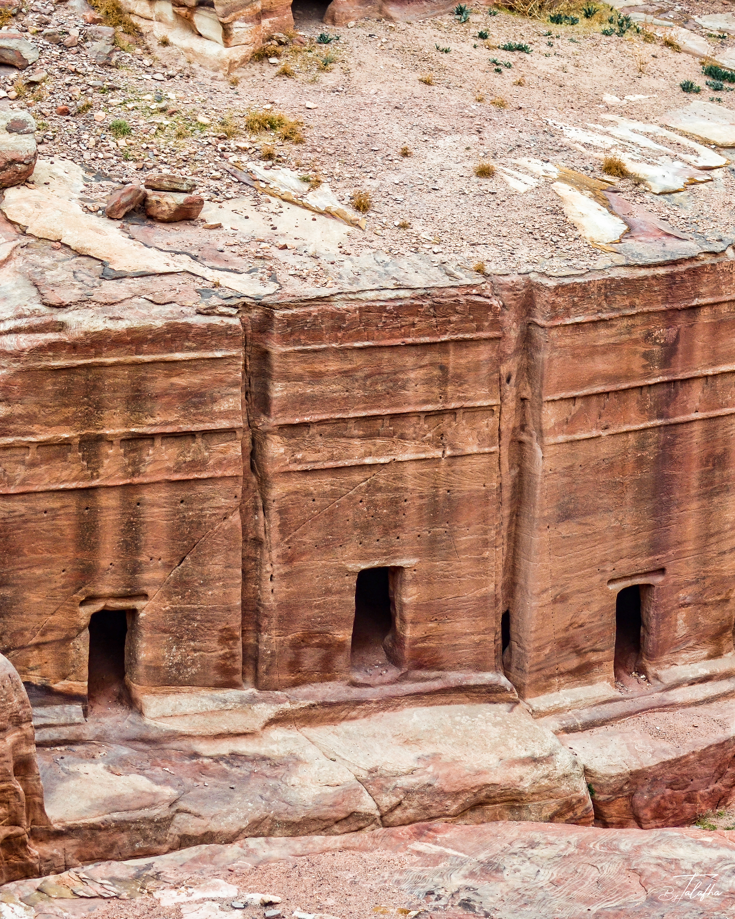
Pylon Tombs of the Theater Necropolis
Rock-cut tomb façades carved into the sandstone immediately above Petra’s ancient theater. The close view records a group of simple entrances set beneath horizontally articulated façades, while the wider photograph places them within the dense funerary landscape surrounding the theater and Street of Facades. These structures belong to Petra’s Theater Necropolis, a concentration of Nabataean rock-cut tombs adjacent to the theater. The façades are identified as pylon tombs, including examples with two friezes of crowsteps, a characteristic form within Nabataean funerary architecture. The record is particularly valuable spatially because it shows that Petra’s theater was not an isolated civic monument. It occupied an already extensively carved funerary landscape, where tombs, circulation routes, rock faces, and later monumental interventions accumulated within the same terrain.
Petra, Maan, Jordan

Black-capped Chickadee
A Black-capped Chickadee moving through dried vegetation at RIM Park in Waterloo during early winter. The sequence shows the bird perched among mature seedheads, clinging beneath a slender stem, and moving close to the snow-covered ground with its wings extended. The black cap and throat, broad white cheeks, grey back, pale underparts, and warm buff flanks clearly identify the species. The photographs also capture the chickadee’s ability to use fine plant structure from multiple orientations, including an inverted position while clinging to a seed-bearing stem. Beyond the species portrait, the record documents the ecological value of standing vegetation through winter. Dried stems and seedheads remain structurally useful after the growing season, providing perches and potential feeding substrates for small resident birds even when the surrounding landscape is snow covered.
RIM Park, Ontario, Canada
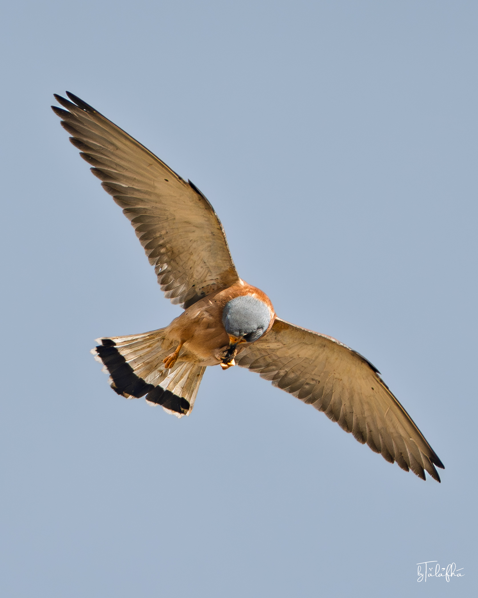
Lesser Kestrel
A male Lesser Kestrel photographed in flight over Kafr Kifiya in Irbid, Jordan, manipulating and eating a small captured prey item while airborne. Across the sequence, the bird holds the prey in its feet and repeatedly lowers its head toward it, with the wings extended to maintain flight. The bird’s pale blue-grey head, warm rufous back and body, relatively unmarked upperparts, pale underwings, and grey tail with a broad dark terminal band are consistent with an adult male Lesser Kestrel. These features distinguish it from the closely related Common Kestrel, particularly the cleaner rufous upperparts and overall male plumage pattern. The record captures a direct feeding interaction within an agricultural or rural landscape. It also illustrates how open airspace above cultivated and village-edge environments forms part of the functional habitat of small falcons, linking prey availability on the ground with aerial movement and feeding behaviour.
كفر كيفيا, Irbid, Jordan
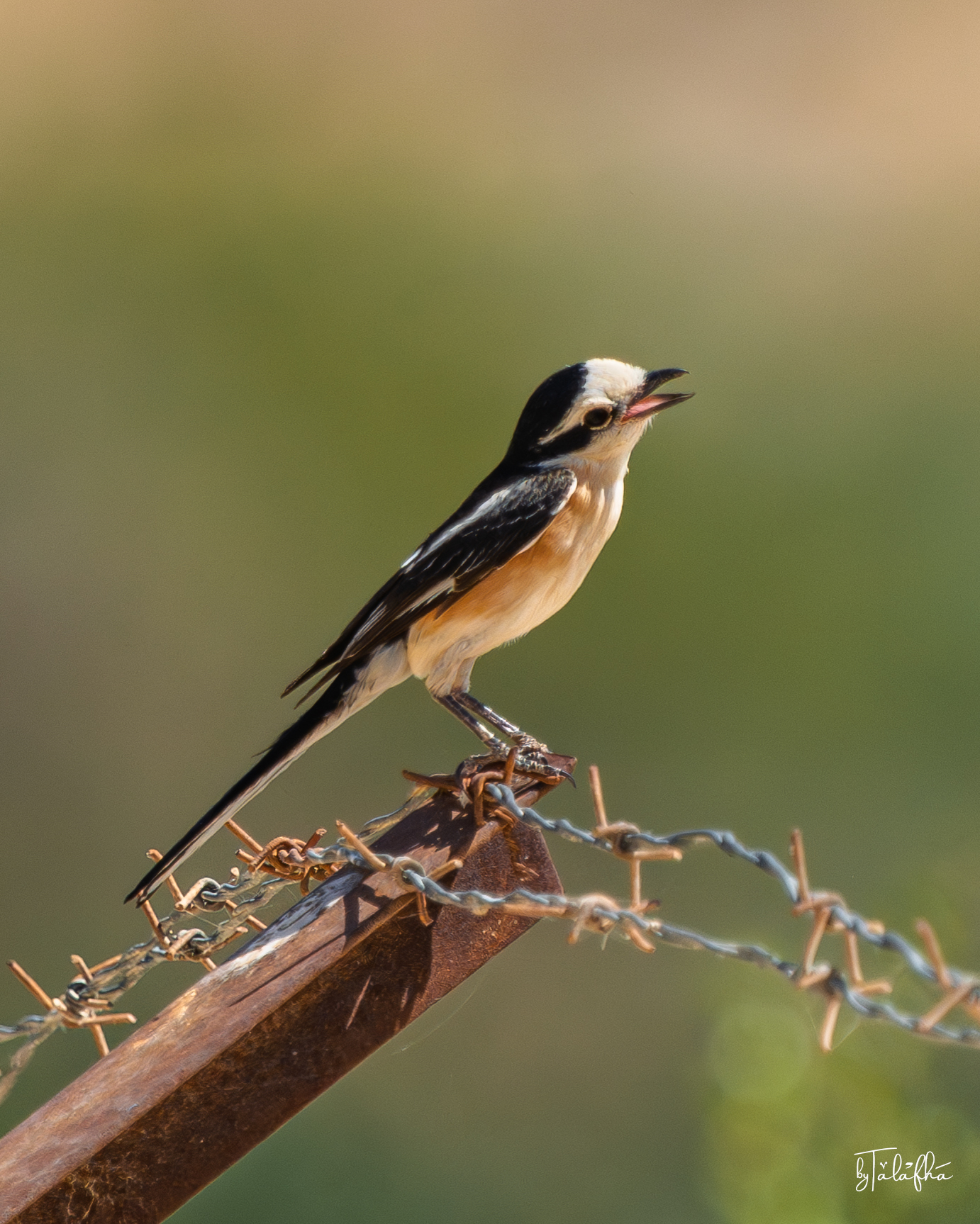
Masked Shrike
A Masked Shrike perched on barbed wire and a rusted metal fence element near Kafrein Dam, Jordan. The bird shows the species’ strongly contrasting black-and-white head and wings, warm buff-orange underparts, and notably long dark tail. In both photographs the bill is open, but the images alone do not establish whether the bird was calling, panting, or responding to another stimulus. This record is especially useful because the perch is clearly human-made. The shrike is using fence infrastructure as an elevated observation point within a vegetated landscape, illustrating how wildlife can incorporate ordinary agricultural or boundary structures into its spatial behaviour. The photographs also capture an important edge condition. Rather than showing wildlife in an untouched setting, the observation records a bird occupying a landscape where vegetation, water infrastructure, fencing, and human land use intersect.
Kafrein Dam, Balqa, Jordan
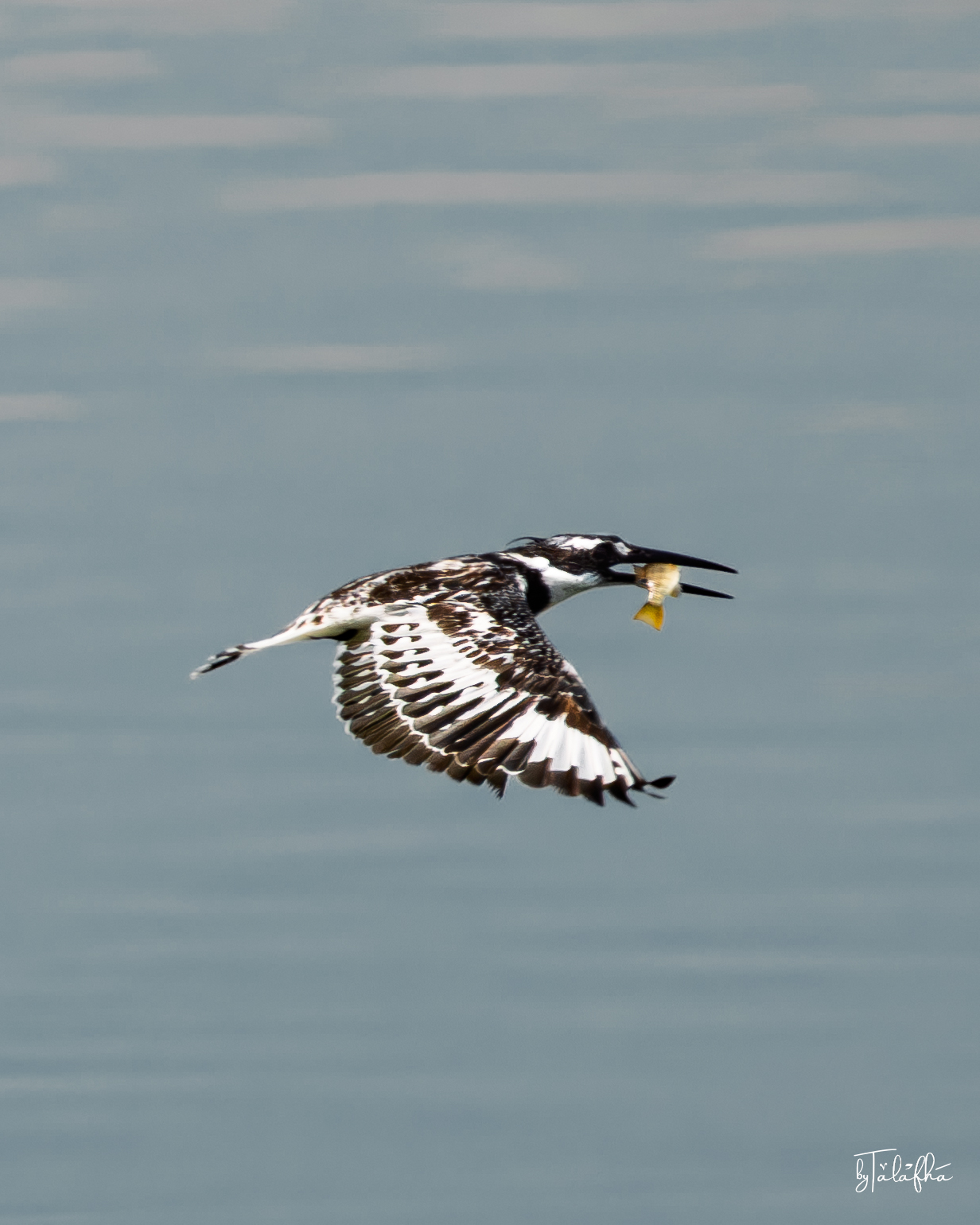
Pied Kingfisher
A Pied Kingfisher photographed over the open water of Kafrein Dam in Jordan. One frame captures the bird suspended in a controlled hover with wings fully extended and bill directed downward, while the second records it in flight carrying a freshly captured fish. The sharply contrasting black-and-white plumage, long pointed bill, crested head, and patterned wings clearly identify the bird as a Pied Kingfisher. Unlike a simple portrait, the sequence records two directly observable stages of feeding behaviour: hovering over the water and transporting captured prey. The observation also illustrates the relationship between an aquatic predator and the open-water environment of a reservoir. For Pied Kingfishers, the water column itself is feeding habitat, while aerial space above it becomes part of the hunting sequence. This makes the record particularly useful for documenting how birds use engineered water landscapes as ecological habitat.
Kafrein Dam, Balqa, Jordan
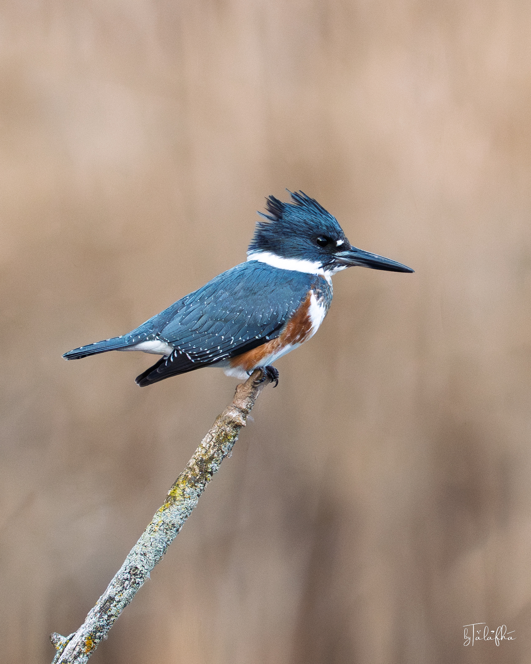
Belted Kingfisher
A Belted Kingfisher perches on an exposed branch at Grindstone Marshes Trail, photographed in late autumn. The sequence shows the bird from both close and wider perspectives, with its large head, shaggy crest, long heavy bill, blue-grey upperparts, white collar, and chestnut banding clearly visible. The chestnut coloration across the lower breast and flanks identifies this individual as a female Belted Kingfisher. The bird remains perched throughout the sequence. Its elevated position on a bare branch provides a clear vantage point above nearby wetland habitat, although the photographs do not establish whether it was actively hunting at the moment of observation. This record is especially strong as field documentation because the subject, perch, and surrounding marsh context all read clearly together. It captures a species closely associated with water while also showing how small vertical elements such as bare branches function as important observation and hunting perches within wetland landscapes.
Grindstone Marshes Trail, Ontario, Canada
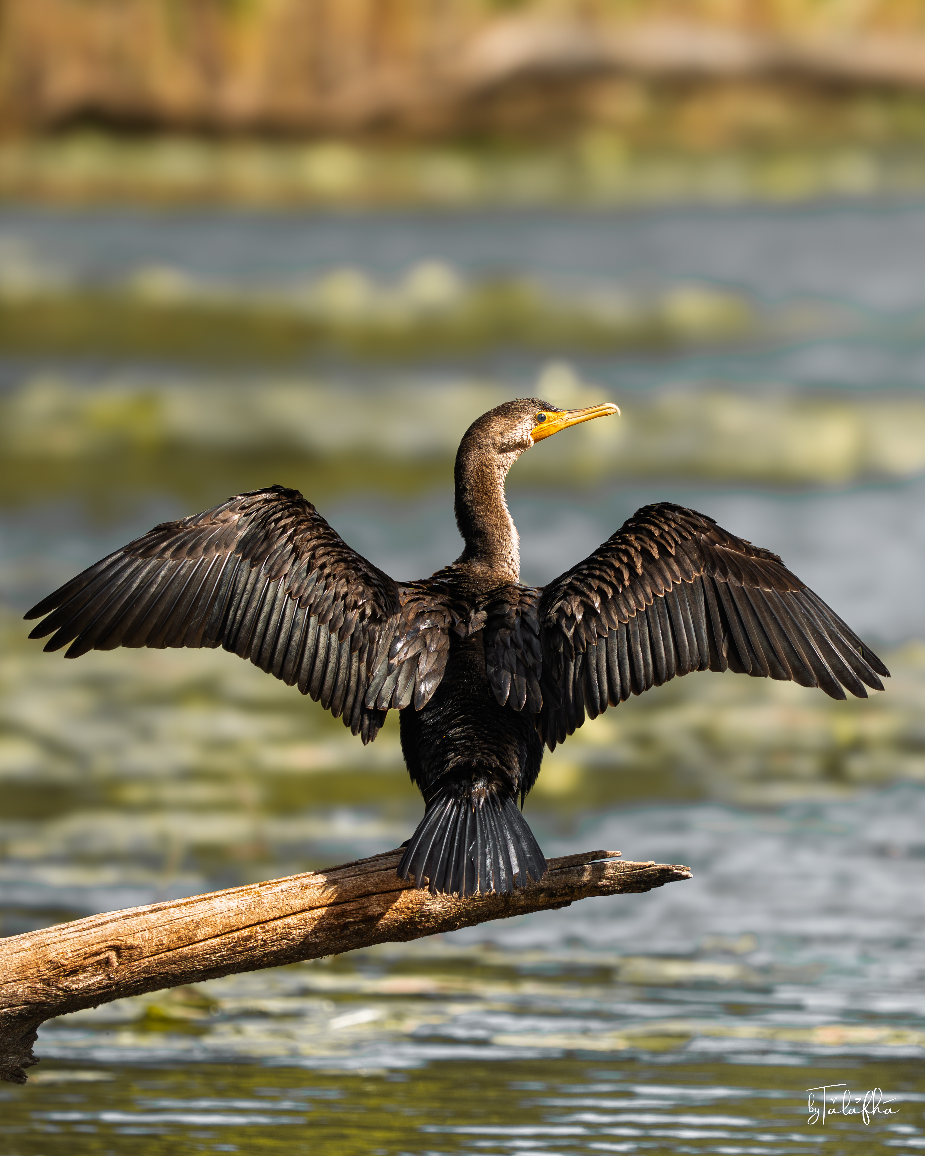
Double-crested Cormorant
A Double-crested Cormorant perched on a sunlit log at Grindstone, photographed at close range in calm wetland water with floating vegetation in the background. The sequence includes a compact resting posture and two frames with the wings spread wide, documenting the characteristic wing-drying pose often associated with cormorants. The bird shows a long slightly hooked bill, bright yellow-orange gular skin at the base of the bill, blue eye, dark body plumage, and a long stiff tail. In the wing-spread frames, the full structure of the flight feathers and the broad open posture are clearly visible. The setting includes open water, a partially submerged perch, and patches of floating aquatic vegetation. As a field record, this observation is useful because it captures both species identity and behaviour in a legible wetland setting. The record shows how emergent perch structure within marsh water functions as a resting and maintenance site for waterbirds, not only as a feeding surface.
Grindstone Marshes Trail, Ontario, Canada
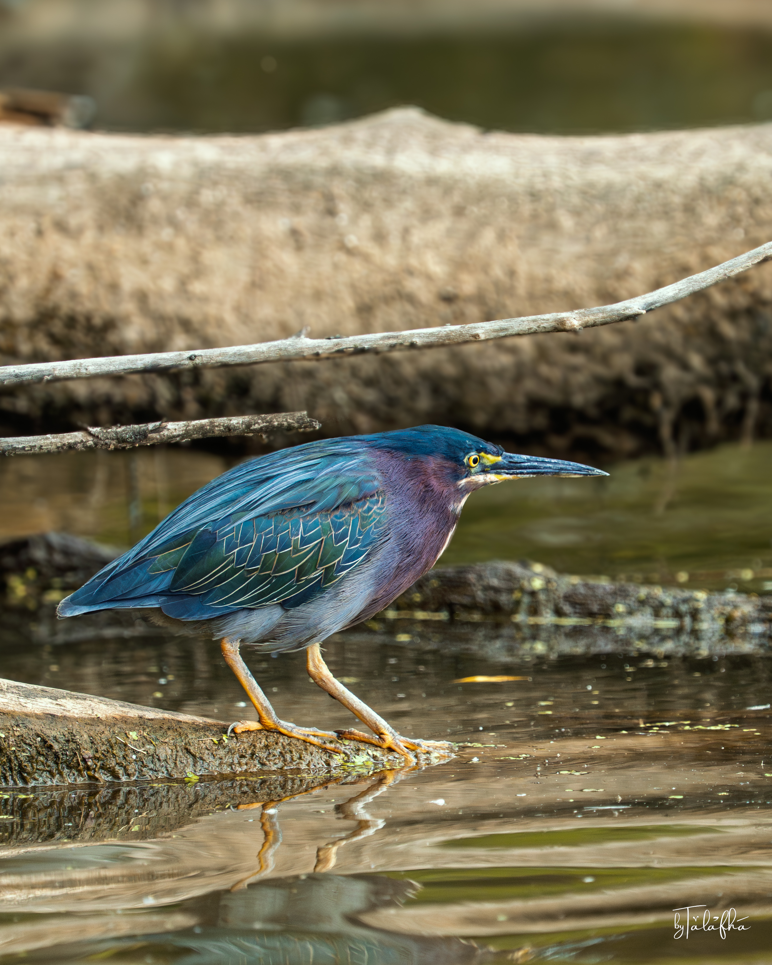
Green Heron
A Green Heron stands low along the edge of shallow water at Grindstone Marshes Trail, using fallen woody material and emergent wetland vegetation as perching and movement surfaces. The two photographs show the bird in slightly different parts of the marsh edge, first among dense stems and then on a partially submerged log close to open water. The bird’s compact form, dark green-blue back, chestnut-toned neck, yellow eye, long pointed bill, and yellow-orange legs strongly support identification as Green Heron. Its crouched posture close to the water is visible, but the photographs do not establish whether it was actively feeding at the moment of capture. The sequence is a useful record of wetland-edge structure at close scale. Fallen branches, shallow water, emergent vegetation, and small open-water gaps together create the kind of physical complexity used by wading birds moving through marsh habitat.
Grindstone Marshes Trail, Ontario, Canada
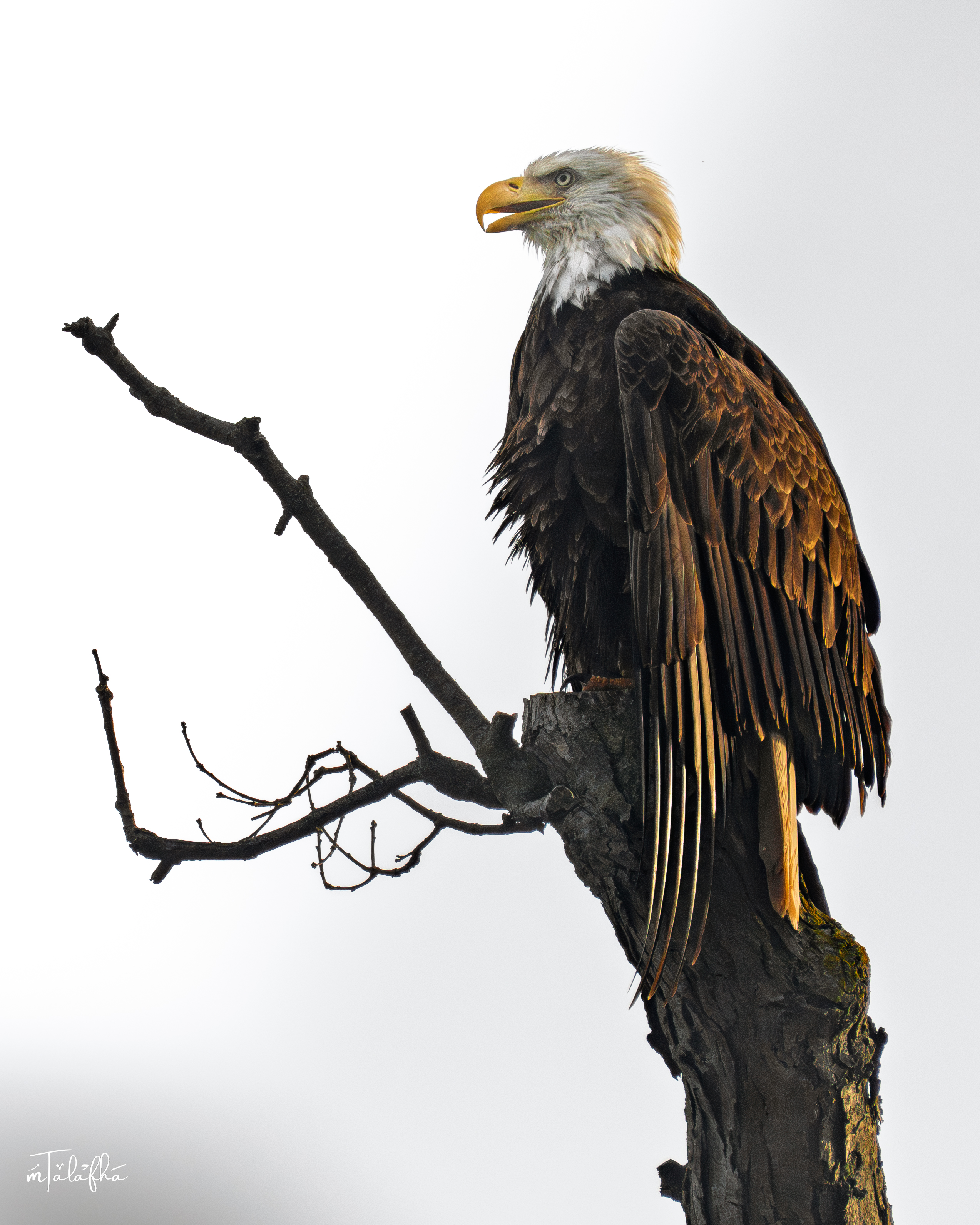
Bald Eagle
An adult Bald Eagle perched high on an exposed tree limb in Bronte, photographed on Canada Day. The sequence shows the bird from several angles, including a close view of the head and upper body and a wider frame that places the eagle within the crown of the tree. The white head and tail, dark brown body and wings, and large yellow hooked bill clearly identify an adult Bald Eagle. The bird is shown resting or perching rather than in active flight or feeding. Its elevated position provides a broad visual field over the surrounding landscape, although the photographs alone do not establish what the bird was observing. This record documents the presence of a large raptor within the Bronte landscape and highlights the ecological role of mature trees and exposed high branches as perching structure. Such features can be important components of habitat even when they appear dead, damaged, or structurally sparse.
Bronte Creek, Ontario, Canada
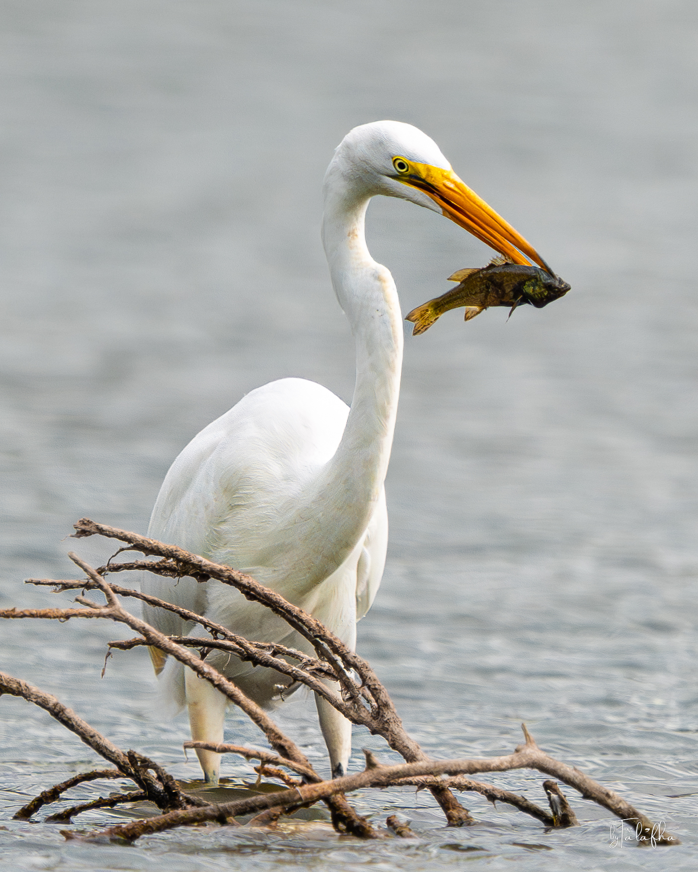
Great Egret
A Great Egret stands in shallow water at Grindstone Marsh with a freshly captured fish held crosswise in its bill. Across the sequence, the bird is shown first securing the fish, then holding it above the water, and finally plunging its bill back into the marsh with wings partly extended for balance. The observation documents active feeding in a shallow wetland environment. The bird’s long white body, elongated neck, yellow-orange bill, yellow-green eye area, and dark legs are consistent with Great Egret. Submerged and partially exposed woody debris is visible around the bird, adding physical structure to the foraging edge. As a field record, the sequence is useful not only as a species observation but also as evidence of how shallow-water habitat functions as feeding space. The visible interaction between bird, prey, water depth, and submerged structure gives the record a clear ecological and spatial dimension.
Grindstone Marshes Trail, Ontario, Canada
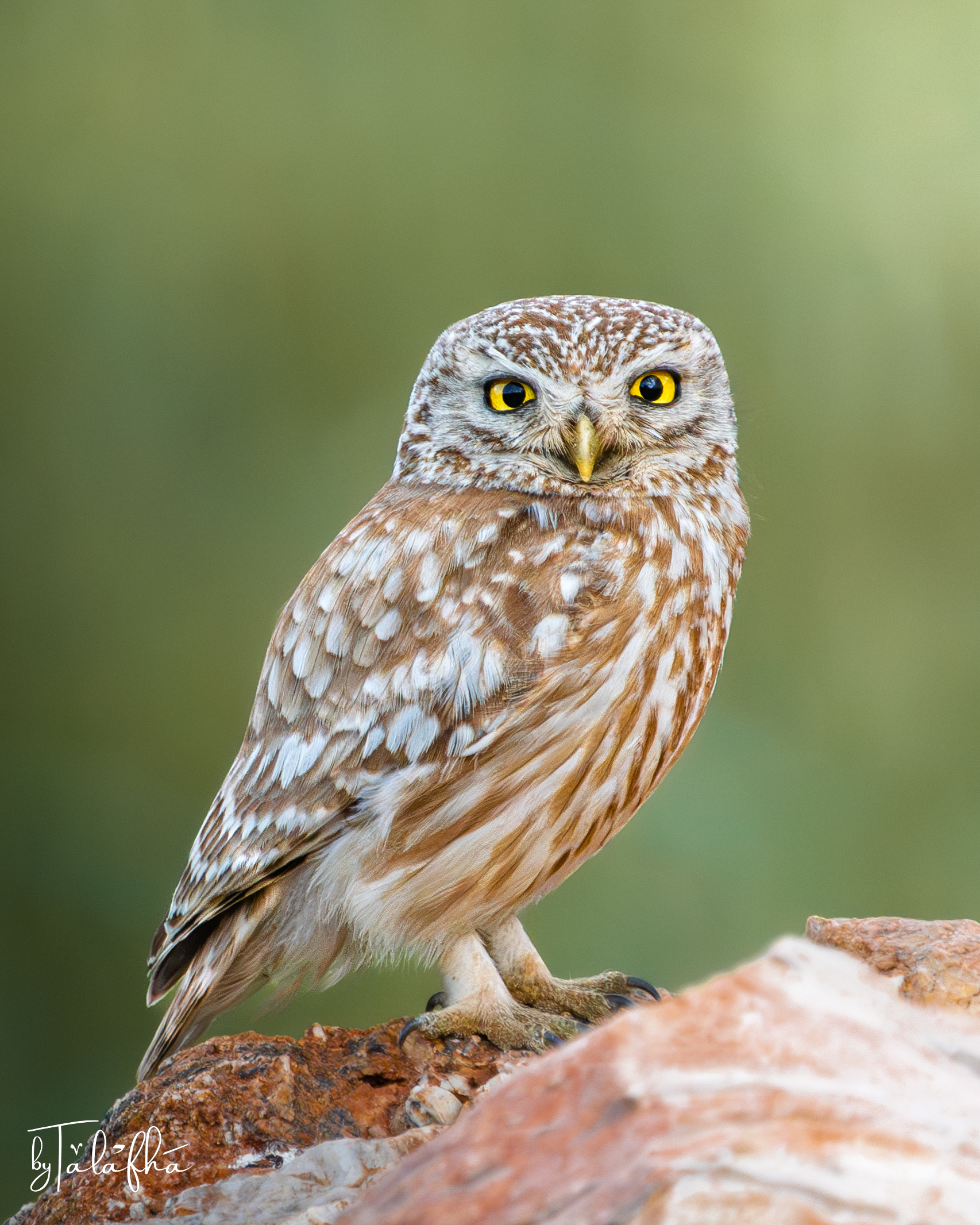
Little Owl
A Little Owl rests on an exposed rocky perch in Irbid, Jordan, facing directly toward the camera. The photograph captures the bird at rest rather than in movement, making details of its plumage, posture, eyes, and relationship to the perch particularly visible. The observation is also spatial. In northern Jordan, rocky ground, agricultural landscapes, stone walls, buildings, field margins, scattered trees, and other human-modified features can form part of the environments used by birds. A perch is therefore more than a photographic setting. It can provide elevation, visibility, shelter nearby, and a position from which an animal reads its surroundings. This single encounter does not establish how the owl uses the wider landscape, where it nests, or the extent of its territory. It does, however, document the presence of a small nocturnal predator within the landscape of Irbid and offers a starting point for observing how wildlife persists alongside agriculture and settlement.
Irbid, Irbid, Jordan
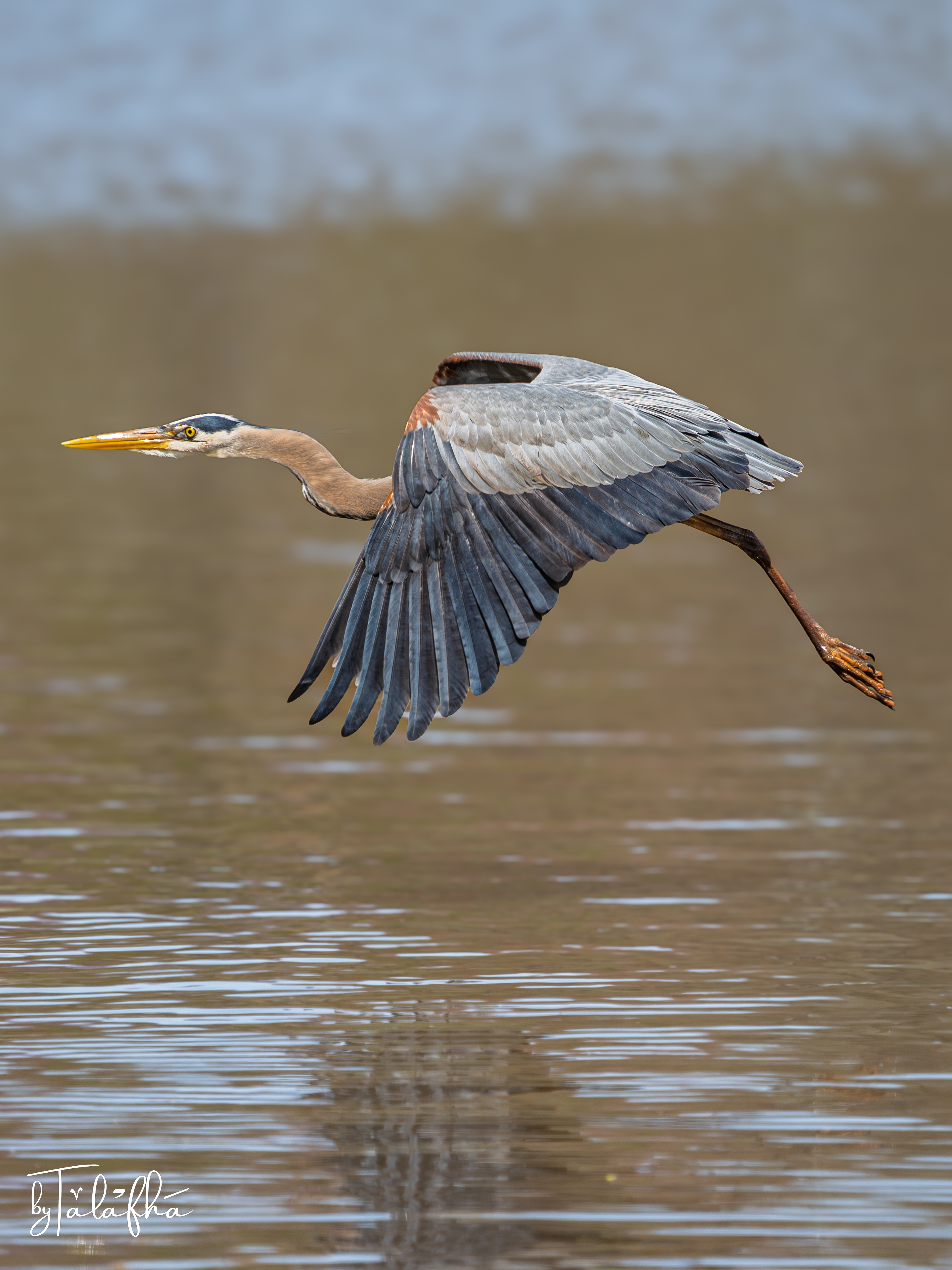
Great Blue Heron
A Great Blue Heron (Ardea herodias) photographed in flight over Grindstone Marsh in Hamilton, Ontario. Seen close to the water, the bird offers more than a portrait of a species. Its movement draws attention to the wetland as a spatial system in which open water, shallow margins, vegetation, resting areas, and nearby habitats can support different parts of an animal’s daily activity. A single photograph cannot reveal the bird’s route, destination, or use of the wider landscape. It can, however, document a moment of movement through that landscape and provide a starting point for asking how wetland structure, habitat continuity, and surrounding land uses shape the spaces available to wildlife.
Grindstone Marshes Trail, Ontario, Canada