
The Cistern as a Planning Unit
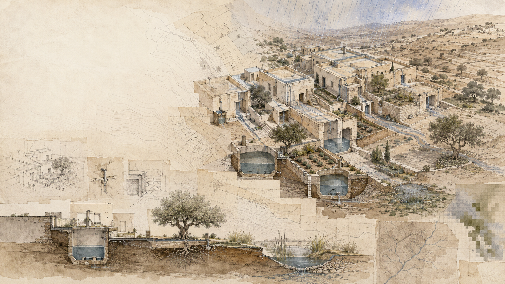
A cistern is easy to see as a container. It becomes more useful when it is read as part of a small water system connecting catchment, rainfall, storage, demand, overflow, maintenance, and the surrounding landscape.
A field guide to reading rainwater cisterns as distributed water infrastructure rather than isolated tanks. It follows water from catchment to conveyance, storage, use, overflow, and maintenance, and shows how planners can map these relationships across buildings, sites, and neighborhoods.
- Written by
- mbtalafha
- Reading time
- 8 min read
Why this matters
A field guide to reading rainwater cisterns as distributed water infrastructure rather than isolated tanks. It follows water from catchment to conveyance, storage, use, overflow, and maintenance, and shows how planners can map these relationships across buildings, sites, and neighborhoods.
The tank is only one part of the system
Rainwater harvesting is often represented by its most visible component: the cistern. Yet storage is only one moment in a longer water path. Rain falls on a catchment, moves through gutters or channels, may pass through screens or diversion devices, enters storage, is withdrawn for a particular use, and eventually leaves through consumption, drainage, leakage, or overflow.
This wider reading matters because the performance of a cistern cannot be understood from its volume alone. Its usefulness depends on the area that supplies it, the timing of rainfall, the demand placed on stored water, the quality requirements associated with that demand, and the way excess water is handled.
For planners, the cistern is therefore best understood as a small infrastructural system embedded in architecture and landscape. The first question is not simply how large the tank is. It is how water moves through the entire site.
Begin with the catchment
The contributing surface establishes the first boundary of a rainwater system. On buildings this is commonly a roof, but courtyards, paved surfaces, terraces, and other designed surfaces may also collect runoff where appropriate.
Potential harvest depends fundamentally on rainfall depth and contributing area, adjusted for losses associated with the collection surface and system. Increasing storage volume cannot compensate for a catchment that rarely supplies enough water to fill it.
The catchment should also be read qualitatively. Material, slope, accumulated dust, vegetation, animals, nearby activities, maintenance, and atmospheric deposition can influence the water reaching storage. This becomes especially important when the harvested water is intended for uses involving greater human exposure.
A useful site survey therefore maps both catchment area and catchment condition. The roof is not simply the background above the tank. It is the first component of the infrastructure.
Trace the complete water path
Follow water in the sequence it would actually travel. Begin at the collection surface and trace gutters, channels, downpipes, screens, first-flush or diversion components where present, filters, junctions, tank inlets, storage, outlets, pumps, distribution lines, drainage, and overflow.
This simple exercise often exposes gaps between a drawing and a functioning system. A downpipe may disappear underground without a clear destination. Several roofs may feed one tank despite being represented separately on architectural plans. An overflow may terminate at a wall even though water ultimately crosses neighboring land.
Drawing the entire path converts a collection of plumbing components into a spatial system. It also reveals where water can be lost, contaminated, redirected, or become difficult to maintain.
Storage is a balance between supply and demand
Cistern capacity is usually expressed as a volume, but storage performance is a relationship through time. Water enters during rainfall events and leaves according to demand. The timing of both matters.
A system may receive enough annual rainfall in total while still running empty during a long dry interval. A large cistern may remain underused if its contributing catchment is too small. Another may overflow frequently because storage is small relative to episodic inflow or because demand is low.
Early planning should therefore ask what period the storage is intended to bridge and what demand it is expected to serve. Detailed sizing can later use rainfall records, runoff assumptions, storage behavior, and demand profiles, but the conceptual water balance should be understood before a tank volume becomes fixed.
Overflow reveals the hidden half of the design
Every finite cistern has a threshold. Once storage is full, additional inflow must leave the system. That makes the overflow one of the most revealing features to trace during fieldwork.
Follow it beyond the tank. Does it discharge onto paving, into a drainage system, beside a foundation, across a property boundary, into an infiltration area, or toward planted ground? Look for sediment, staining, erosion, dampness, blocked outlets, disconnected pipes, or vegetation responding to repeated moisture.
This is where rainwater harvesting becomes landscape planning. Capturing water is only half of the design problem. The other half is deciding what happens when water cannot be stored.
A cistern can reduce or delay runoff from part of a rainfall event, but it should not be treated as infinite storage. The receiving landscape and drainage system remain part of the design.
Intended use determines water-quality questions
Rainwater should not be treated as having one universal quality requirement. The controls needed depend on how the collected water will be used. Irrigation, toilet flushing, cleaning, process uses, and drinking can involve very different exposure pathways and regulatory requirements.
For drinking-water applications, preventive risk management begins before the tank. Catchment condition, screens, protected storage, sanitary access, contamination pathways, treatment, and ongoing inspection all matter. First-flush or diversion devices may reduce the amount of accumulated debris and contamination entering storage, but they do not replace a complete risk-management approach.
For planning review, the important discipline is to make intended use explicit. A plan labelled only rainwater tank leaves a critical question unanswered: stored for what?
Maintenance occupies real space
Distributed infrastructure brings operation and maintenance close to the building or site. Gutters require cleaning. Screens become blocked. Sediment can accumulate. Pumps and valves require access. Storage vessels may require inspection. Overflow routes can be obstructed or altered over time.
These tasks have spatial consequences. A filter concealed behind permanent construction, an inaccessible inspection opening, or a tank surrounded by later development may be technically present while becoming operationally weak.
During design review, look for the physical route required to inspect and maintain the system. Identify access covers, screens, filters, pumps where present, isolation valves, drainage points, and overflow outlets. Maintenance should be visible in the layout rather than left as a note added after the system has been placed.
A field sequence for reading a cistern system
Define the contributing catchment and its surface condition Trace gutters, channels, and downpipes without assuming where they terminate Identify screens, filters, diversion devices, bypasses, and disconnected components Record the tank location, type, approximate capacity, accessibility, and visible condition Identify the intended uses of stored water Trace distribution from the tank toward those uses Follow the overflow to its actual receiving surface or drainage system Look for leakage, sediment, staining, erosion, blocked inlets, and uncontrolled discharge Record how the system can be inspected, cleaned, repaired, and operated Return to the site plan and draw the complete water path as one connected system
Define the contributing catchment and its surface condition
Trace gutters, channels, and downpipes without assuming where they terminate
Identify screens, filters, diversion devices, bypasses, and disconnected components
Record the tank location, type, approximate capacity, accessibility, and visible condition
Identify the intended uses of stored water
Trace distribution from the tank toward those uses
Follow the overflow to its actual receiving surface or drainage system
Look for leakage, sediment, staining, erosion, blocked inlets, and uncontrolled discharge
Record how the system can be inspected, cleaned, repaired, and operated
Return to the site plan and draw the complete water path as one connected system
From individual cisterns to distributed infrastructure
One cistern is a small intervention. Many cisterns distributed across roofs, courtyards, institutions, housing, commercial buildings, and public landscapes become a planning layer.
At that scale, different questions emerge. How much roof area contributes to storage? Where is stored water used? Which buildings have useful non-potable demands? Where do overflows converge? Which systems depend on pumps? Where can excess rainfall enter soil or vegetation? Who is responsible for maintenance?
GIS can help make this distributed infrastructure visible by linking building footprints, catchment areas, storage, demand, drainage, land cover, and ownership. The objective is not to pretend that decentralized storage replaces centralized water supply or stormwater infrastructure. It is to understand it as one additional layer within the wider urban water system.
The planning opportunity lies in making these layers work together rather than treating each tank as an isolated sustainability feature.
From knowledge to action
Practical applications
Map roof catchments and likely water demand during early site analysis rather than adding cisterns after the layout is fixed.
Draw the full catchment-to-overflow path during planning and interdisciplinary design reviews.
Connect cistern overflow with drainage, infiltration, soil, vegetation, and appropriate landscape functions.
Require the intended use of harvested water to be identified so water-quality controls can respond to actual exposure.
Include inspection and maintenance access when assessing the spatial requirements of decentralized water infrastructure.
Use GIS to inventory contributing roof area, storage capacity, overflow destinations, and potential non-potable demands across larger sites or districts.
Evaluate cisterns within a wider site water balance that includes rainfall, runoff, demand, infiltration, evapotranspiration, drainage, and storage.
Document failed or disconnected components during field surveys because they reveal where performance depends on maintenance and management.
Carry into the field
Questions for planners
What surface actually supplies this cistern?
How much of that catchment is hydraulically connected to storage?
What demand is the stored water intended to serve?
Does storage capacity make sense in relation to catchment area, rainfall timing, and demand?
Where does water go when the cistern is full?
What contamination risks exist between catchment and point of use?
Can every important component be inspected, cleaned, and repaired?
Could overflow be connected more deliberately to drainage, infiltration, vegetation, or another appropriate site function?
What changes when many individual cisterns are understood as one distributed infrastructure network?
References
Sources for continued reading.
- 01Source ↗
World Health Organization. 2026. Sanitary inspection package (drinking-water): rainwater collection and storage. Guidance for identifying sanitary risks and managing rainwater collection and storage systems.
- 02Source ↗
World Health Organization. Sanitary inspection packages: a supporting tool for the Guidelines for drinking-water quality: small water supplies. Guidance linking sanitary inspection with preventive risk management for small water supplies.
- 03Source ↗
Critchley, W. and Siegert, K. 1991. Water Harvesting: A Manual for the Design and Construction of Water Harvesting Schemes for Plant Production. Food and Agriculture Organization of the United Nations.
- 04Source ↗
Mekdaschi Studer, R. and Liniger, H. 2013. Water Harvesting: Guidelines to Good Practice. Guidance on selecting and planning water-harvesting approaches according to environmental, technical, and management conditions.
- 05Source ↗
United Nations Environment Programme. 2009. Rainwater Harvesting: A Lifeline for Human Well-being. A synthesis of rainwater harvesting as landscape water management for human and ecosystem needs.
Connected Knowledge
Continue through the relationships surrounding this record.
Follow what this record touches next.
Cities
Cities are shaped by institutions, infrastructure, markets, households, conflict, care, and everyday negotiation.
Continue →