land
Land records relationships between ecology, ownership, terrain, history, biodiversity, and development.
This world reads landscapes before proposals, treating soil, slope, habitat, memory, and tenure as active planning knowledge.
Questions that organize this world
Start with the question.
- 01What does a landscape reveal before construction?
- 02Who owns land, and who belongs to it?
- 03How do soils, habitats, and topography shape settlement?
Satellite images can show green returning to Qa al-Azraq. They cannot tell us, by themselves, whether the oasis has returned, or whether the water regime sustaining that recovery is itself sustainable.
The Wetland Seen From Space: What Greenness Means at Qa al-Azraq
A research-led reading of vegetation recovery at Qa al-Azraq in Jordan. Satellite analysis documented a major expansion of vegetation between 2015 and 2025, while bird monitoring, groundwater evidence, and the artificial pumping that sustains part of the wetland reveal a more complicated ecological story. The article asks not only what remote sensing can show about recovery, but what kind of water future can sustain Azraq without reproducing pressure on its depleted aquifer.
Read field guide →Some of Wadi Rum's darkest surfaces are not the colour of the sandstone itself. They are thin mineral-rich coatings assembled slowly at the boundary between rock, dust, water, atmosphere, and microscopic life.
The Dark Skin of Stone: Desert Varnish in Wadi Rum
A close reading of desert varnish in Wadi Rum, Jordan, from its clay, iron, and manganese-rich composition to the unresolved question of how it forms. The article also considers the relationship between dark rock coatings, weathering, and the extraordinary record of petroglyphs and inscriptions preserved across the protected landscape.
Read field guide →Across the gravel plains and wadis of southern Jordan, acacia trees stand far apart. Yet each one gathers shade, soil, moisture, insects, birds, mammals, and traces of water into a small concentration of life.
Under the Acacia Crown: Trees of Wadi Araba
An ecological reading of the native acacias of Wadi Araba, Jordan, exploring their relationship with water, landform, soil, shade, and other species. Rather than treating the trees as isolated botanical objects, the article looks at the small ecological worlds that form beneath and around their crowns.
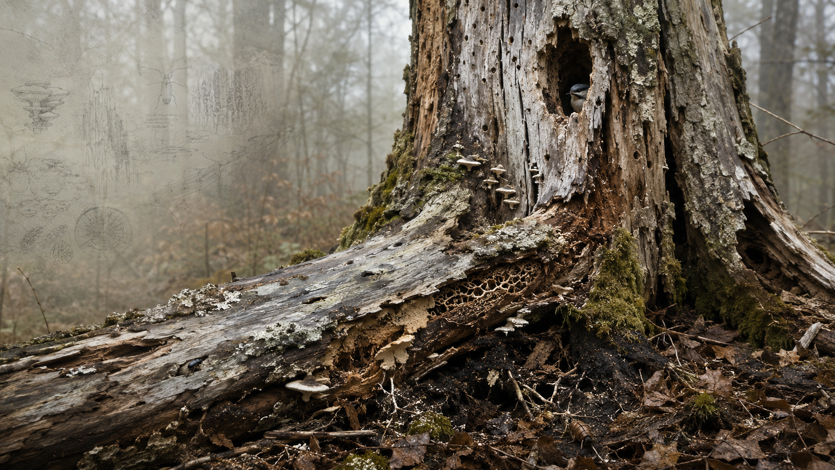
Read field guide →The death of a tree does not end its ecological life. It changes it. Bark loosens, cavities deepen, fungi enter, insects arrive, moisture collects, birds investigate, and wood slowly becomes part of the soil.
A Dead Tree Is Still Habitat
A short ecological reading of deadwood as habitat rather than waste. Standing snags, fallen trunks, cavities, bark, fungi, decaying heartwood, and contact with soil create a changing sequence of habitats used by organisms at different stages of decomposition. The article invites a slower way of looking at dead trees, not as empty remains, but as structures still participating in biodiversity, nutrient cycling, carbon dynamics, and forest renewal.
Read field guide →Where should sanitation investment go first? This research translated that question into a spatial decision-support framework by combining infrastructure, population, groundwater, land, rainfall, and other vulnerability indicators across Jordan.
Mapping Sanitation Vulnerability in Jordan
This research developed a GIS-based Sanitation Hotspot Index for Jordan to identify districts and neighborhoods with the greatest need for sanitation intervention. Using the Analytic Hierarchy Process, expert and stakeholder input, and multiple spatial datasets, the study combined ten criteria into a national vulnerability model. The resulting maps were designed to support sanitation planning, funding allocation, donor prioritization, and infrastructure investment.
Read field guide →A wastewater treatment system does not have to hide behind concrete walls and mechanical equipment. In a constructed wetland, treatment can become a living landscape where water, plants, microorganisms, soil, and time do much of the work.
Constructed Wetlands: When Wastewater Treatment Becomes Landscape
A Field Guide to constructed wetlands as nature-based wastewater infrastructure. It explains how engineered wetland systems treat wastewater through physical, biological, and chemical processes while offering opportunities for low-energy operation, decentralized treatment, water reuse, biodiversity enhancement, landscape integration, and circular resource management. It also examines their limitations, including land requirements, pretreatment, clogging, maintenance, and the need to match treatment performance with intended reuse.
Read field guide →A plan can show where things are. A section can show how ground, water, buildings, vegetation, infrastructure, and people actually meet.
Why Sections Reveal What Plans Hide
A Field Guide to the section drawing as a planning instrument rather than a presentation graphic. It explains how sections reveal vertical relationships that maps can flatten, how to choose meaningful transects, how to combine field observation with GIS and topographic data, and how sectional thinking can expose hydrological, ecological, infrastructural, and urban relationships before planning decisions are fixed.
Read field guide →The endurance of ancient water infrastructure was not produced by construction alone. Water systems remained useful because people could enter them, clean them, remove sediment, repair masonry, restore channels, manage flows, and repeat the work when conditions changed.
Ancient Water Systems Were Built to Be Maintained
A historic lesson about maintenance as an integral part of water infrastructure. The guide reads access shafts, inspection openings, sediment traps, repair masonry, channel linings, overflow routes, and maintenance paths as evidence that water systems were designed for continued intervention rather than permanent completion. It connects archaeological observation with contemporary planning questions about accessibility, stewardship, repair, and the long-term operation of decentralized infrastructure.
Read field guide →Shade is often treated as an amenity added after streets and public spaces are designed. In hot climates, it is closer to infrastructure: it shapes where people can walk, wait, gather, rest, and remain outdoors.
Shade as Urban Infrastructure
A Field Guide to reading shade as a spatial system rather than a decorative feature. It explains how solar exposure, street geometry, trees, arcades, canopies, surface materials, season, and time of day combine to shape outdoor comfort, and shows how planners can map and design shade networks across streets, transit stops, public spaces, and everyday walking routes.
Read field guide →A cistern is easy to see as a container. It becomes more useful when it is read as part of a small water system connecting catchment, rainfall, storage, demand, overflow, maintenance, and the surrounding landscape.
The Cistern as a Planning Unit
A field guide to reading rainwater cisterns as distributed water infrastructure rather than isolated tanks. It follows water from catchment to conveyance, storage, use, overflow, and maintenance, and shows how planners can map these relationships across buildings, sites, and neighborhoods.
Read field guide →A terrace wall is easy to notice. The larger system is harder to see: slope, runoff, soil, infiltration, cultivation, overflow, repair, and the repeated labor that keeps the landscape functioning.
Reading Terraces as Slow Infrastructure
A field guide to reading terraces as landscape infrastructure rather than isolated walls. It explains how terraces alter slope geometry, runoff pathways, soil retention, cultivation, and maintenance, and offers a practical method for interpreting terrace systems through topography, field evidence, historical imagery, and GIS.
Read field guide →A channel, cistern, terrace, shaft, or dam is rarely the whole water system. The larger story is written into the slopes, catchments, routes, soils, storage spaces, and maintenance paths that connect these structures.
Reading Ancient Water Systems as Landscape Infrastructure
A field guide to reading ancient water systems as complete landscape infrastructures rather than isolated monuments. It offers a method for tracing water from source to use, distinguishing capture from conveyance and storage, recognizing the role of topography and maintenance, using GIS carefully, and interpreting surviving remains without overstating their original function.
Read field guide →Search this world
Related places
Field Collection
Connected Knowledge
Continue through the relationships surrounding this record.