
Central index
Search across articles, concepts, methods, places, and Field Collection records without forcing knowledge into one format.
Knowledge Library.
Knowledge index
12 records
Results reflect every active URL filter and can be bookmarked or shared.
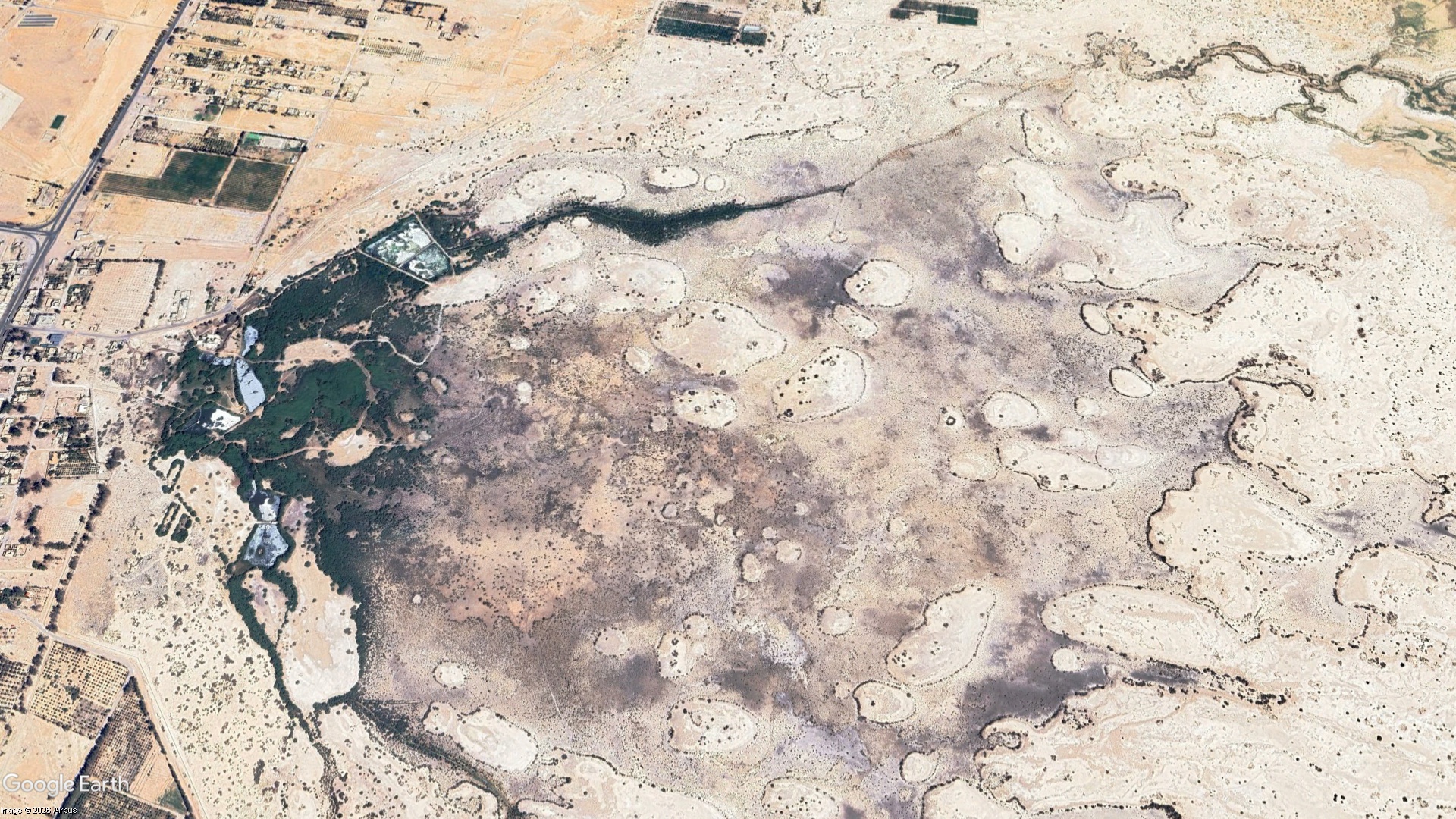
The Wetland Seen From Space: What Greenness Means at Qa al-Azraq
A research-led reading of vegetation recovery at Qa al-Azraq in Jordan. Satellite analysis documented a major expansion of vegetation between 2015 and 2025, while bird monitoring, groundwater evidence, and the artificial pumping that sustains part of the wetland reveal a more complicated ecological story. The article asks not only what remote sensing can show about recovery, but what kind of water future can sustain Azraq without reproducing pressure on its depleted aquifer.
Azraq Wetland Reserve, Zarqa
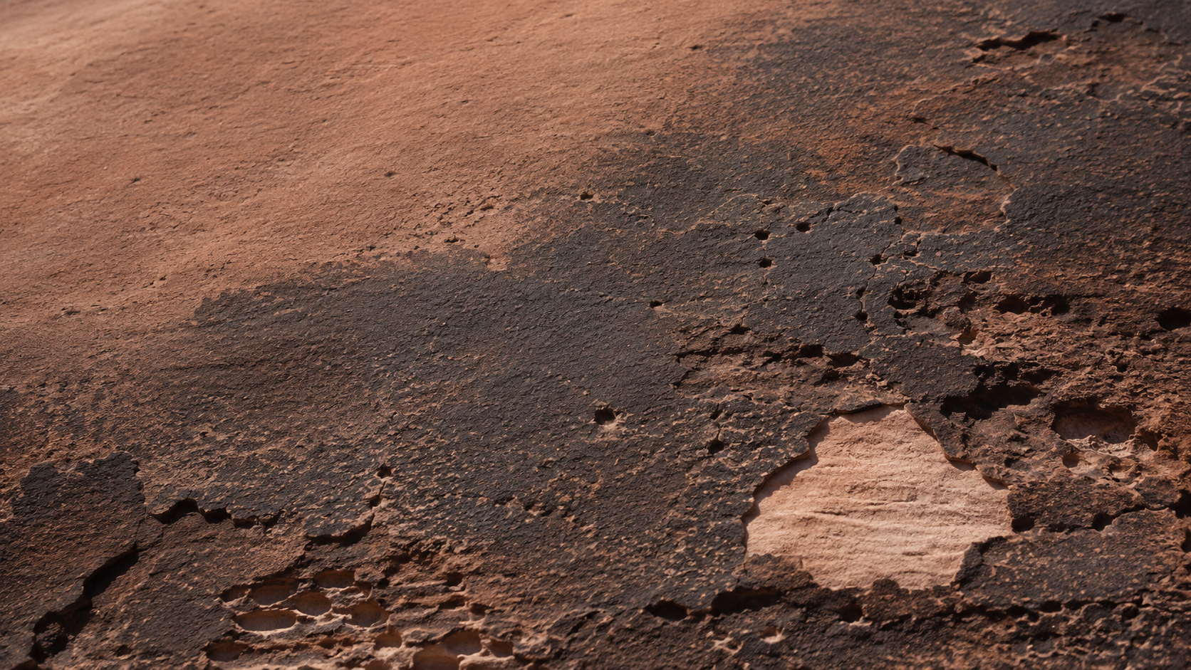
The Dark Skin of Stone: Desert Varnish in Wadi Rum
A close reading of desert varnish in Wadi Rum, Jordan, from its clay, iron, and manganese-rich composition to the unresolved question of how it forms. The article also considers the relationship between dark rock coatings, weathering, and the extraordinary record of petroglyphs and inscriptions preserved across the protected landscape.
Wadi Rum Protected Area, Aqaba
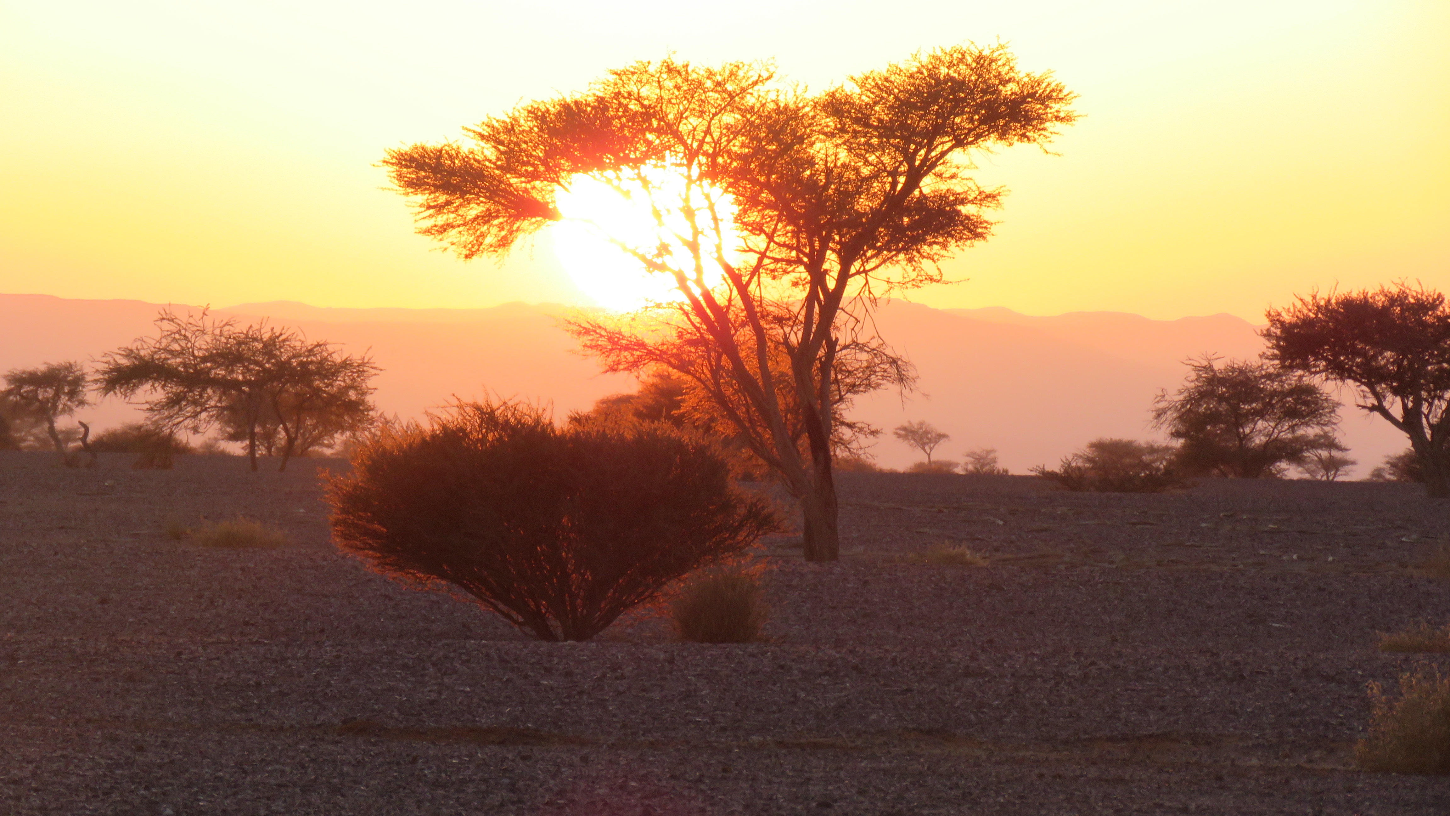
Under the Acacia Crown: Trees of Wadi Araba
An ecological reading of the native acacias of Wadi Araba, Jordan, exploring their relationship with water, landform, soil, shade, and other species. Rather than treating the trees as isolated botanical objects, the article looks at the small ecological worlds that form beneath and around their crowns.
Wadi Araba Sub-District, Aqaba
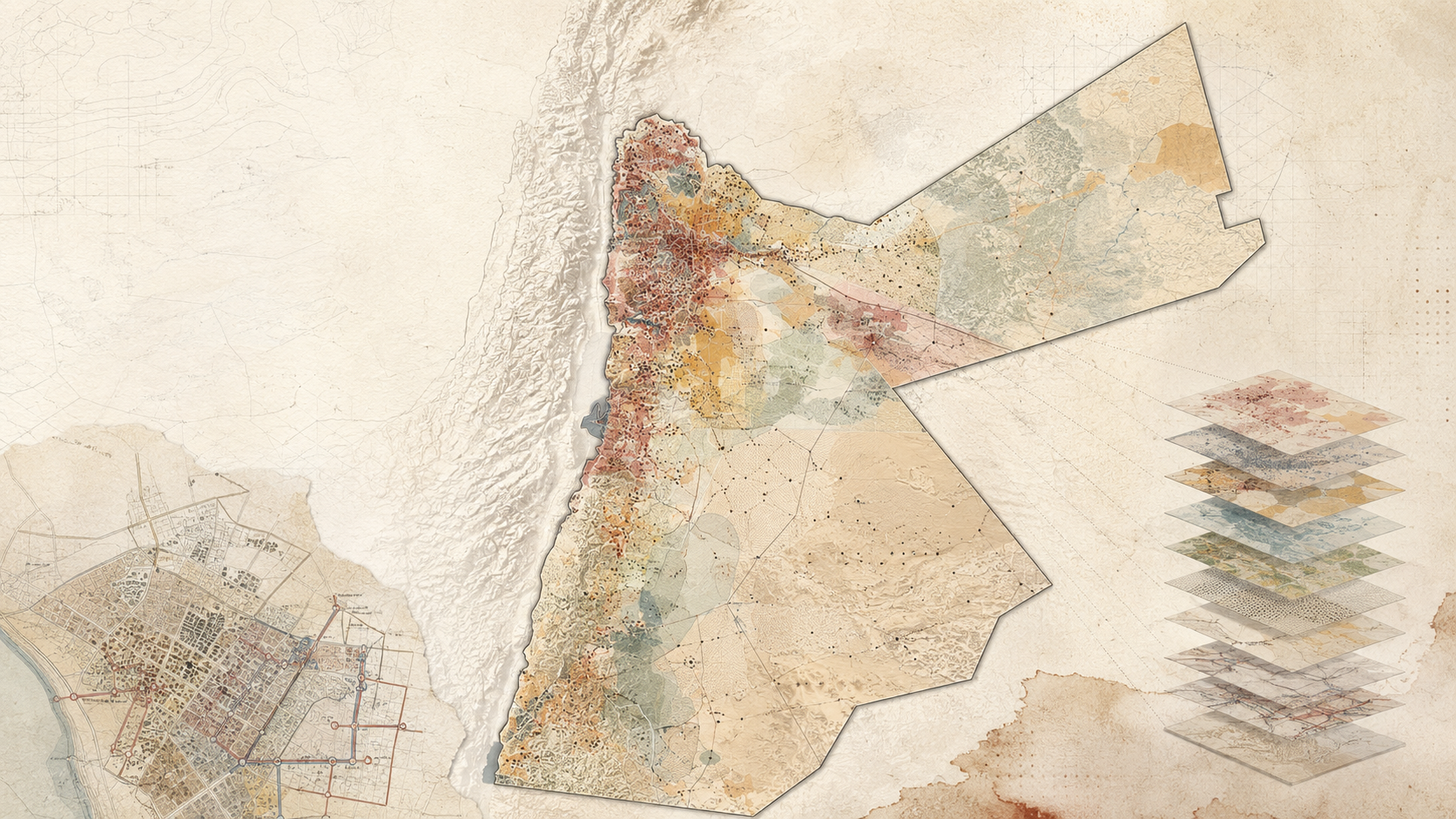
Mapping Sanitation Vulnerability in Jordan
This research developed a GIS-based Sanitation Hotspot Index for Jordan to identify districts and neighborhoods with the greatest need for sanitation intervention. Using the Analytic Hierarchy Process, expert and stakeholder input, and multiple spatial datasets, the study combined ten criteria into a national vulnerability model. The resulting maps were designed to support sanitation planning, funding allocation, donor prioritization, and infrastructure investment.
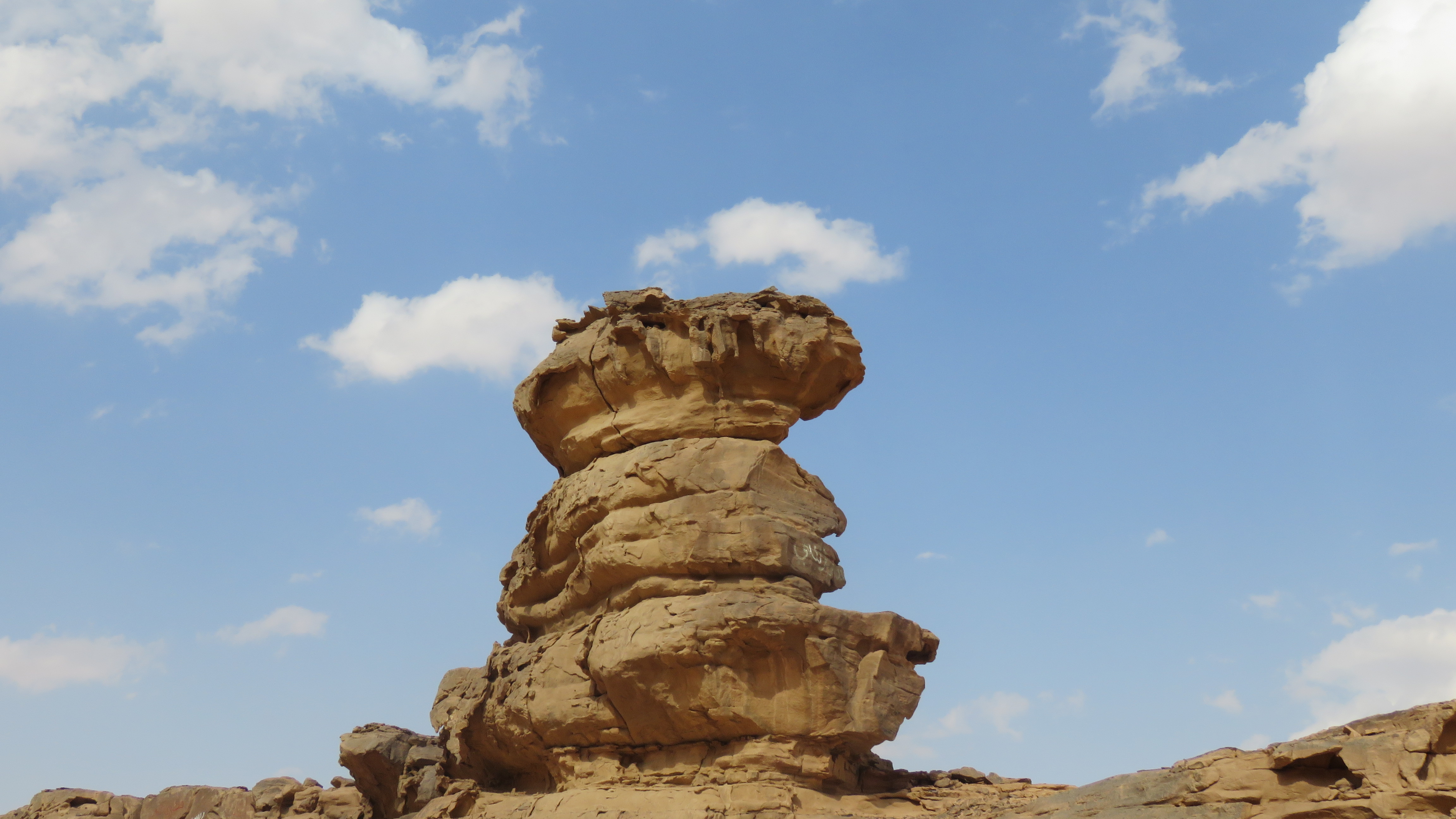
Hoodoo-like sandstone formation
A freestanding sandstone formation rises above a low rocky escarpment near Disi, east of Wadi Rum. The feature consists of stacked, irregularly weathered rock masses, with a broader resistant cap above narrower eroded sections. From different angles, the formation reads as a compact column shaped by differential weathering rather than a single uniform block. The surrounding landscape is dry and sparsely vegetated, with exposed sandstone, sandy deposits, and low rocky benches. The photographs show the formation at both landscape and close scales, making its layered structure and undercut surfaces clearly visible. The term “hoodoo” is reasonable as a descriptive geomorphological label here because the rock has a column-like form with differential erosion between harder and softer layers. However, without geological mapping or site-specific geomorphological documentation, I would avoid presenting a precise formation mechanism beyond that general interpretation.
Wadi Rum Protected Area, Aqaba, Jordan
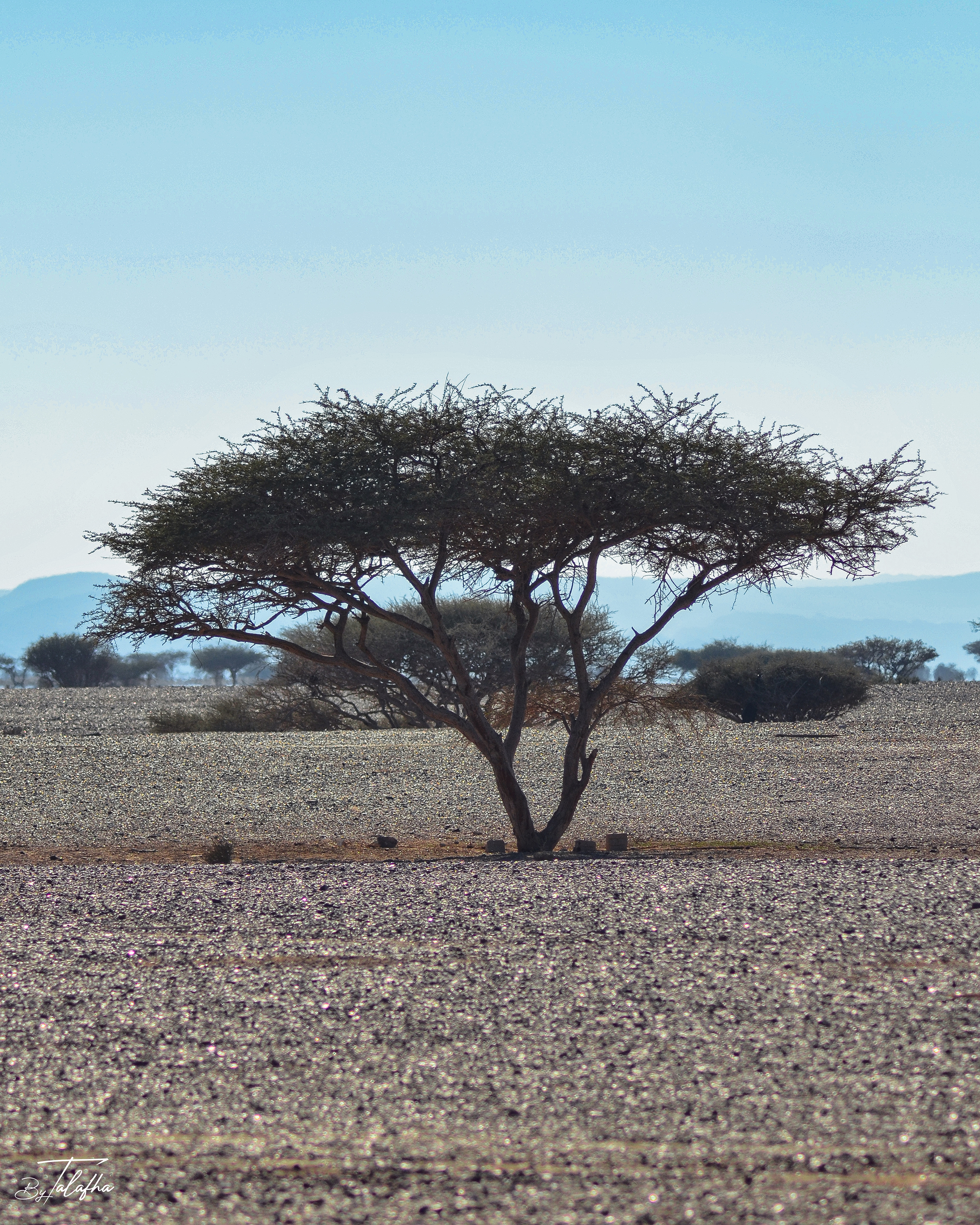
Umbrella thorn acacia
Scattered acacia trees and thorny shrubs occupy an open gravel plain in Wadi Araba, Jordan. The sequence records several growth forms, from broad flat-topped trees with open branching structures to denser, lower shrubs, all standing within a sparsely vegetated arid landscape of gravel, sand, and distant mountain ridges. The larger trees show the characteristic architecture often associated with drought-adapted acacias of southern Jordan, including spreading crowns, multiple stems, small leaves, and widely spaced growth across dry terrain. However, the photographs do not show enough diagnostic detail of leaves, pods, flowers, or thorns to support a confident species-level identification. As a Field Record, the value of the sequence lies as much in the landscape pattern as in the plants themselves. These trees punctuate an otherwise open desert surface, creating shade, vertical structure, and localized habitat in one of Jordan’s driest environments.
Wadi Araba Sub-District, Aqaba, Jordan
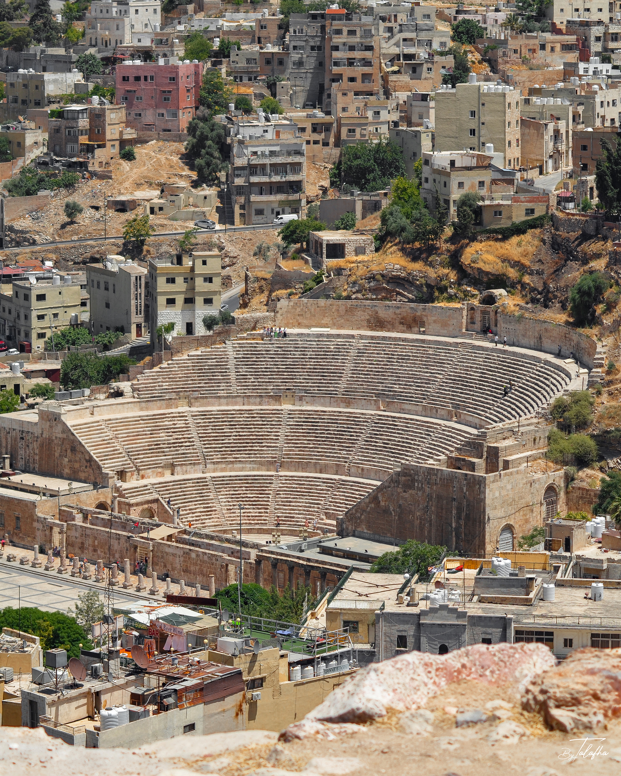
Roman Theater of Amman
A high-angle view of the Roman Theater in central Amman, framed not as an isolated archaeological monument but as part of the contemporary city surrounding it. The semicircular cavea, stage complex, masonry walls, and adjoining archaeological remains are clearly visible, while dense residential and commercial development rises immediately behind the site. The photograph records a strong spatial contrast between the ancient theater and the modern urban fabric. Buildings, roads, retaining walls, rooftop water tanks, vegetation, vacant parcels, and steep topography all appear within the same frame. The theater is therefore read not only as a heritage object, but as a surviving urban structure embedded within a continuously inhabited and changing city. For a Field Record, this image is particularly valuable because it documents continuity and juxtaposition. Archaeology and everyday urban life are not separated here. They occupy the same hillside landscape, making the photograph relevant to questions of heritage conservation, urban morphology, visibility, tourism, and the relationship between historic monuments and contemporary development.
Roman Theater, Amman, Jordan
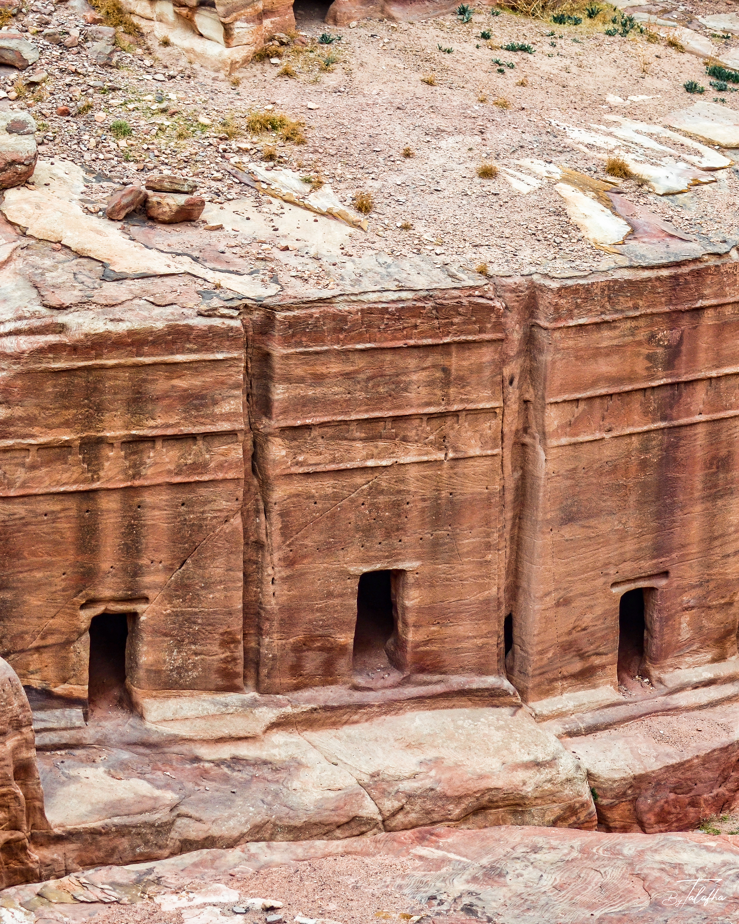
Pylon Tombs of the Theater Necropolis
Rock-cut tomb façades carved into the sandstone immediately above Petra’s ancient theater. The close view records a group of simple entrances set beneath horizontally articulated façades, while the wider photograph places them within the dense funerary landscape surrounding the theater and Street of Facades. These structures belong to Petra’s Theater Necropolis, a concentration of Nabataean rock-cut tombs adjacent to the theater. The façades are identified as pylon tombs, including examples with two friezes of crowsteps, a characteristic form within Nabataean funerary architecture. The record is particularly valuable spatially because it shows that Petra’s theater was not an isolated civic monument. It occupied an already extensively carved funerary landscape, where tombs, circulation routes, rock faces, and later monumental interventions accumulated within the same terrain.
Petra, Maan, Jordan
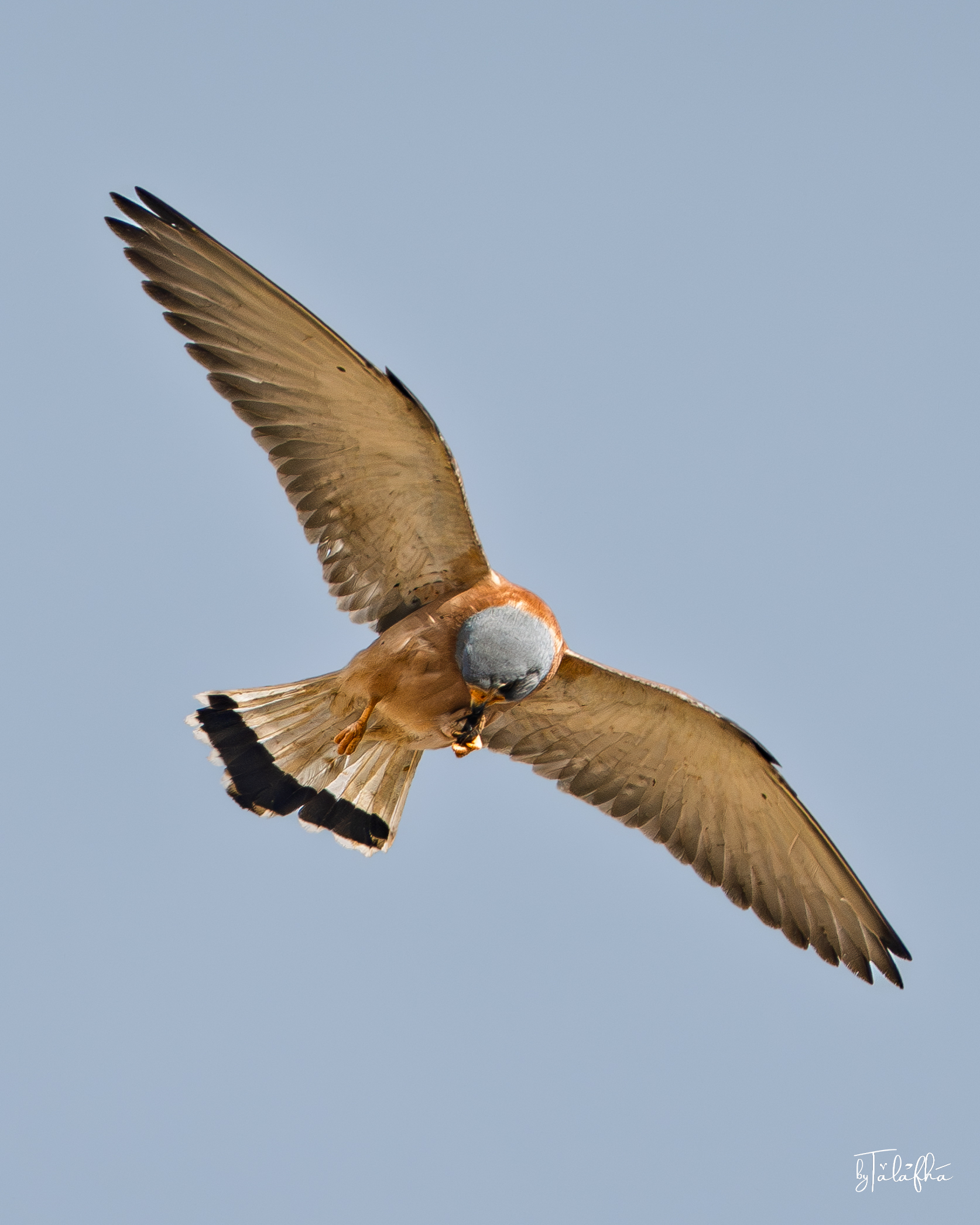
Lesser Kestrel
A male Lesser Kestrel photographed in flight over Kafr Kifiya in Irbid, Jordan, manipulating and eating a small captured prey item while airborne. Across the sequence, the bird holds the prey in its feet and repeatedly lowers its head toward it, with the wings extended to maintain flight. The bird’s pale blue-grey head, warm rufous back and body, relatively unmarked upperparts, pale underwings, and grey tail with a broad dark terminal band are consistent with an adult male Lesser Kestrel. These features distinguish it from the closely related Common Kestrel, particularly the cleaner rufous upperparts and overall male plumage pattern. The record captures a direct feeding interaction within an agricultural or rural landscape. It also illustrates how open airspace above cultivated and village-edge environments forms part of the functional habitat of small falcons, linking prey availability on the ground with aerial movement and feeding behaviour.
كفر كيفيا, Irbid, Jordan
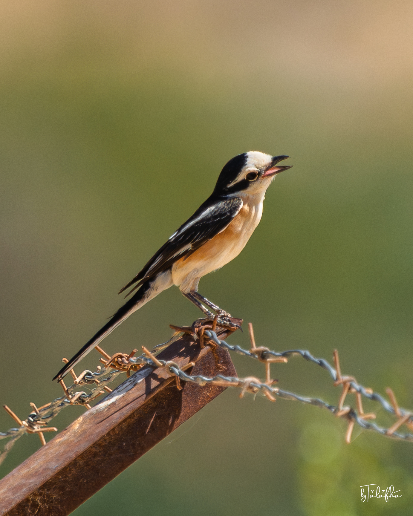
Masked Shrike
A Masked Shrike perched on barbed wire and a rusted metal fence element near Kafrein Dam, Jordan. The bird shows the species’ strongly contrasting black-and-white head and wings, warm buff-orange underparts, and notably long dark tail. In both photographs the bill is open, but the images alone do not establish whether the bird was calling, panting, or responding to another stimulus. This record is especially useful because the perch is clearly human-made. The shrike is using fence infrastructure as an elevated observation point within a vegetated landscape, illustrating how wildlife can incorporate ordinary agricultural or boundary structures into its spatial behaviour. The photographs also capture an important edge condition. Rather than showing wildlife in an untouched setting, the observation records a bird occupying a landscape where vegetation, water infrastructure, fencing, and human land use intersect.
Kafrein Dam, Balqa, Jordan
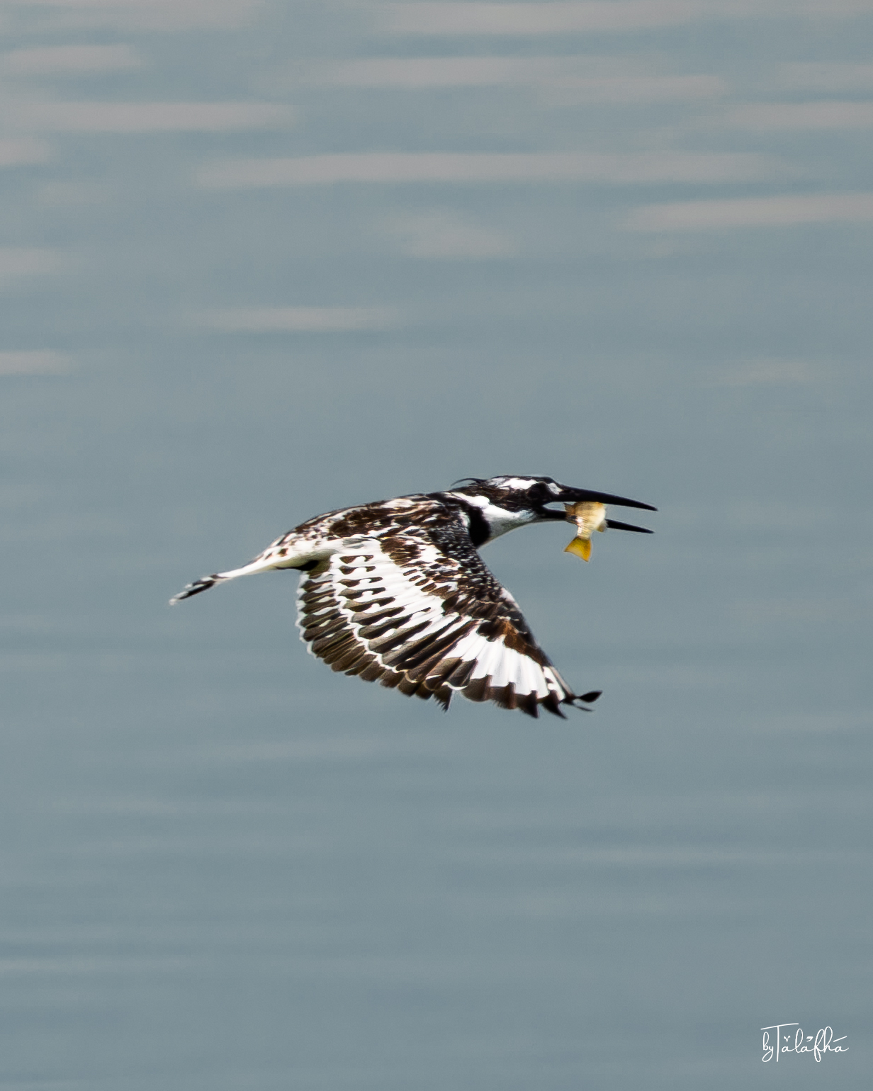
Pied Kingfisher
A Pied Kingfisher photographed over the open water of Kafrein Dam in Jordan. One frame captures the bird suspended in a controlled hover with wings fully extended and bill directed downward, while the second records it in flight carrying a freshly captured fish. The sharply contrasting black-and-white plumage, long pointed bill, crested head, and patterned wings clearly identify the bird as a Pied Kingfisher. Unlike a simple portrait, the sequence records two directly observable stages of feeding behaviour: hovering over the water and transporting captured prey. The observation also illustrates the relationship between an aquatic predator and the open-water environment of a reservoir. For Pied Kingfishers, the water column itself is feeding habitat, while aerial space above it becomes part of the hunting sequence. This makes the record particularly useful for documenting how birds use engineered water landscapes as ecological habitat.
Kafrein Dam, Balqa, Jordan
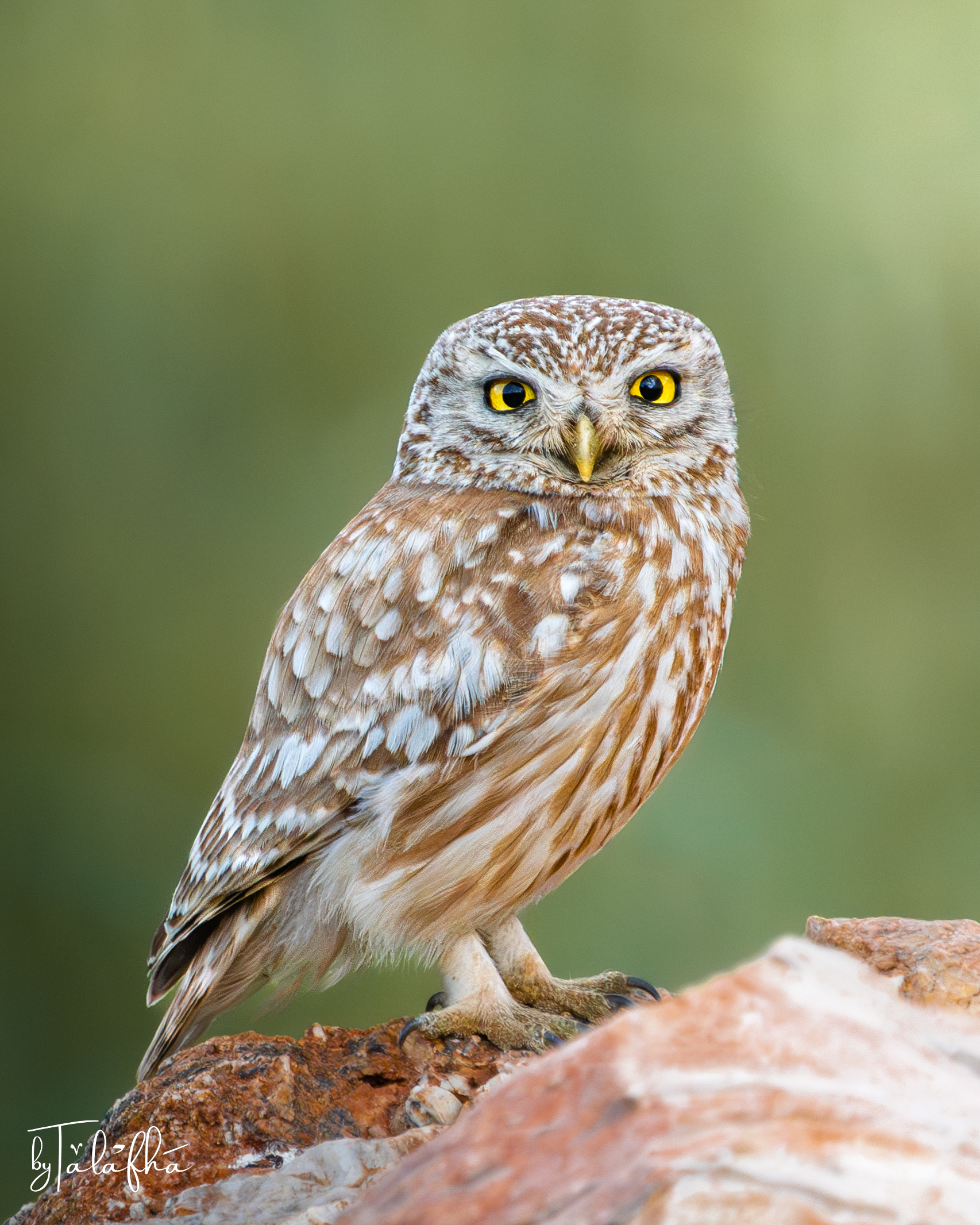
Little Owl
A Little Owl rests on an exposed rocky perch in Irbid, Jordan, facing directly toward the camera. The photograph captures the bird at rest rather than in movement, making details of its plumage, posture, eyes, and relationship to the perch particularly visible. The observation is also spatial. In northern Jordan, rocky ground, agricultural landscapes, stone walls, buildings, field margins, scattered trees, and other human-modified features can form part of the environments used by birds. A perch is therefore more than a photographic setting. It can provide elevation, visibility, shelter nearby, and a position from which an animal reads its surroundings. This single encounter does not establish how the owl uses the wider landscape, where it nests, or the extent of its territory. It does, however, document the presence of a small nocturnal predator within the landscape of Irbid and offers a starting point for observing how wildlife persists alongside agriculture and settlement.
Irbid, Irbid, Jordan